At Ouster, we work with global municipalities to build safe, equitable transportation systems. Part of these conversations revolve around how to the effectively implement new technology – from simulating the curb coverage of a high-risk intersection to ensuring citizen privacy is always protected.
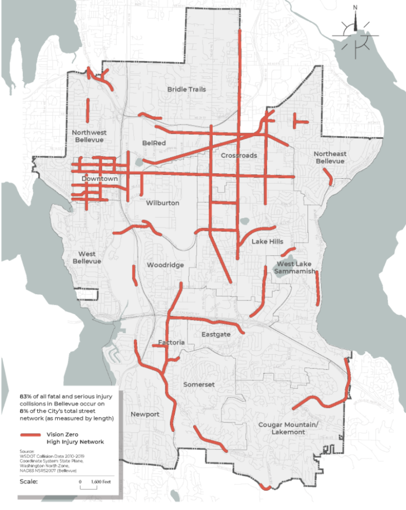
In this year’s Vision Zero and Technology Roundtable hosted by the City of Bellevue, Ouster joined other public and private partners to discuss how to harness technology to improve safety. We discussed technological advancements for road user safety, implementation strategies, and rapid brainstorming of action plans.
Just like how technology has dramatically transformed vehicles and other forms of mobility, technology can also transform roads and communities. In this post, we share some key takeaways from the roundtable on how you can harness technology to improve road safety. Access the full report here.

To learn more about how Ouster lidar can help you achieve your safety goals, reach out to our team!
Core tenants
A user-first approach that considers all vulnerable road users
Pedestrians often get the blame when accidents happen. Reasons like jaywalking, wearing dark clothing at night, or crossing outside of the crosswalk often overshadow the root of the problem. The reality is that our roads today are dangerous for pedestrians by design. Roads are often designed for vehicles, and not for pedestrians, bicyclists, or other micro-mobility users.

Additionally, the risk of injury is not evenly distributed. Pedestrians aged 70+ or those who are disabled are most susceptible to serious injury if struck in an accident. Pedestrians in lower income neighborhoods are also more susceptible to fatalities if an accident occurs.

This is why achieving Vision Zero requires addressing the most vulnerable of all vulnerable road users. It requires taking an honest look at the way streets and cities are planned today, and identifying ways to make roads safer and more equitable.
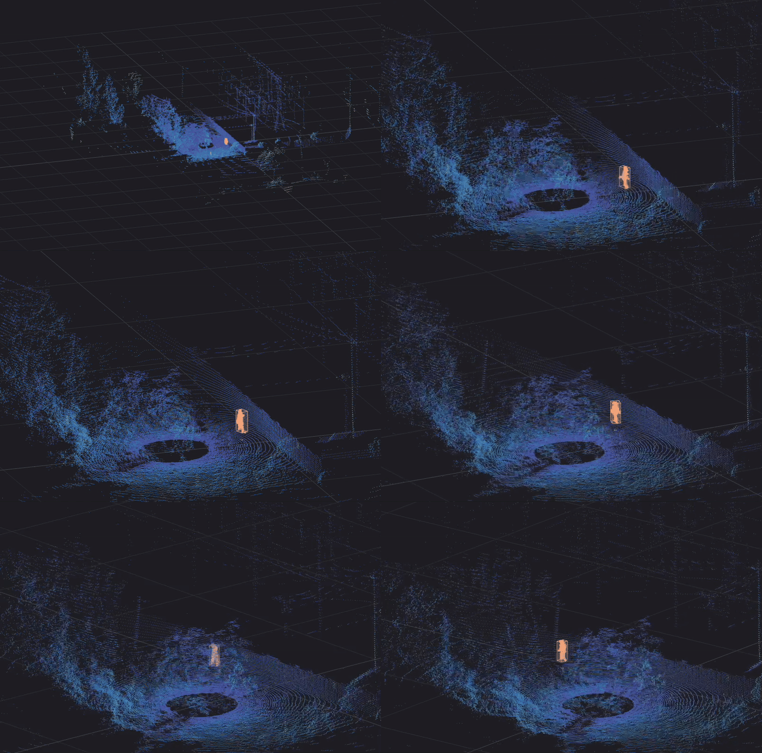
Technology has a big role to play in helping create safer, more equitable transportation systems. For example, lidar can be used to identify pedestrians who need additional time to safely clear the crosswalk and automatically extend the green phase. Some research has been done using lidar to advance intersection safety, and any sustainable approach to Vision Zero must take these considerations into account.
Measure, test, and measure again
“It’s critical that we aren’t just relying on existing crash data to improve safety, that we’re proactively identifying locations that have high risk of crashes, but that may not yet have resulted in actual crashes.” – Jennifer Homendy, Chairperson of the National Transportation Safety Board (NTSB)
Historical data only tells half of the story. Making tangible progress requires taking a proactive approach to understanding how roads are being used and the behaviors of road users today. Data can drive where and how to make both real-time decisions and long-term planning. This could be improving safety at a crosswalk near a school zone, restructuring the road geometry that is causing dangerous blind spots, or prioritizing bicyclist safety measures in a busy downtown area.
Whatever it is, the data doesn’t lie – and accurate data is required to understand the baseline. From there, we can start making iterative improvements and measure progress against those investments.

Taking this iterative approach requires collecting data through all parts of the process and under all edge cases. Many states have already started collecting this data as part of the FHWA Model Inventory of Data Elements, and the Federal Highway Administration (FHWA) recently announced that all states will be required to collect standard road datasets by 2026. Detection technology, such as lidar, will play a critical role as states work to standardize and include pedestrian and bicyclist data into this inventory.
Community engagement and trust in the way technologies and data are being used
Achieving Vision Zero is a joint responsibility. Community engagement is important, and especially around education on Vision Zero initiatives and the types of technologies being implemented. With new detection technologies, citizens may have concerns around personal privacy or facial recognition. In addition to selecting technologies that do not collect any personally identifiable information, cities should also remain transparent about when the data is collected, how it will be used, and with whom it’ll be shared.
As an example, the City of Dublin in Ireland created a digital twin of the city and open-sourced it to all citizens. Citizens can view the publicly-available digital twin and give feedback on urban planning, on the proposed buildings and parks, and on real-time issues such as flooding or litter. Learn more about how Ouster lidar can be used to create privacy-safe digital twins of your city. Lidar, as an example, does not collect any facial recognition data, making it an appropriate choice for any large-scale detection solution in cities.

A shared responsibility
The path to Vision Zero will require partnerships across the public and private sector, across the traffic engineers and the urban planners, across the drivers and the pedestrians, and even across Ouster lidar sensors and other technologies.
Ouster partners with municipalities to design and implement solutions to improve road user safety. Our digital lidar solutions provide cities with an unmatched level of data on everything that’s happening on their streets at any time, all the time.
We can help you take the first foundational step towards achieving safer, more equitable roads. Learn more about what Ouster is doing for road safety and Vision Zero and reach out to our team!


