
Smart Infrastructure for Smart Cities
Multimodal actuation, real-time alerts, and advanced analytics in a single system.
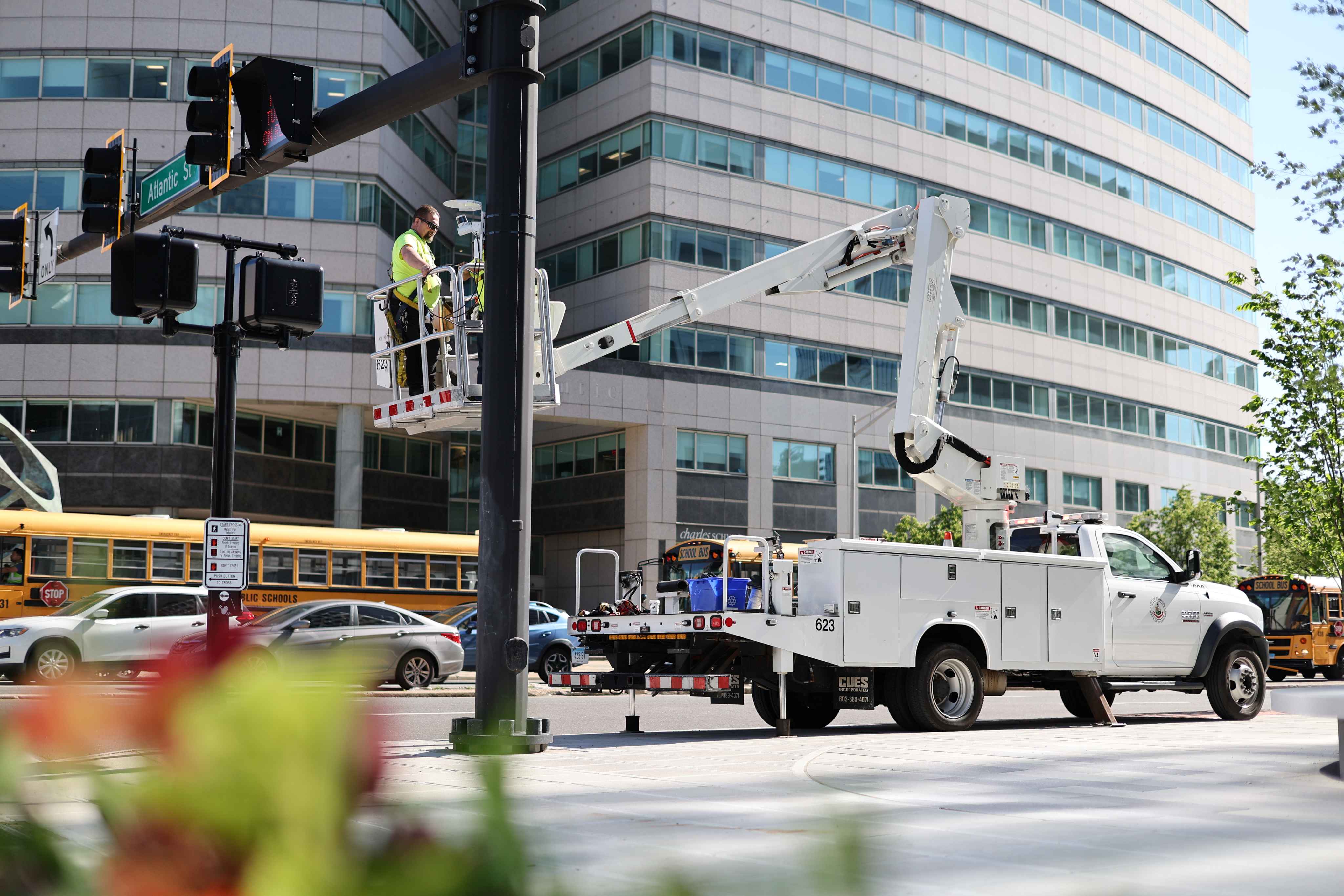
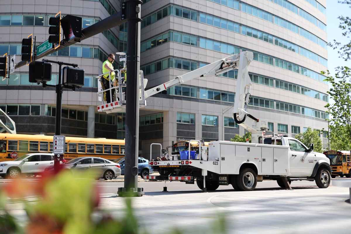
Ouster BlueCity
Utilizing the power of Ouster 3D lidar and proprietary AI software, Ouster BlueCity provides long-range detection and tracking of road users up to 500 ft in a single system to optimize mobility, enhance operations and increase road user safety.
BABA Certified
Complies with NEMA TS2
ISO 27001


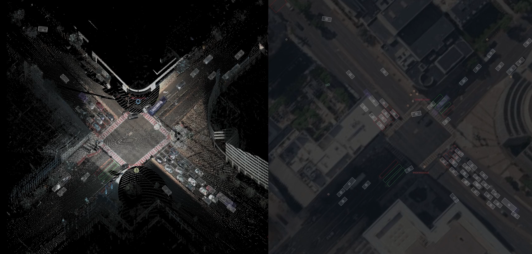
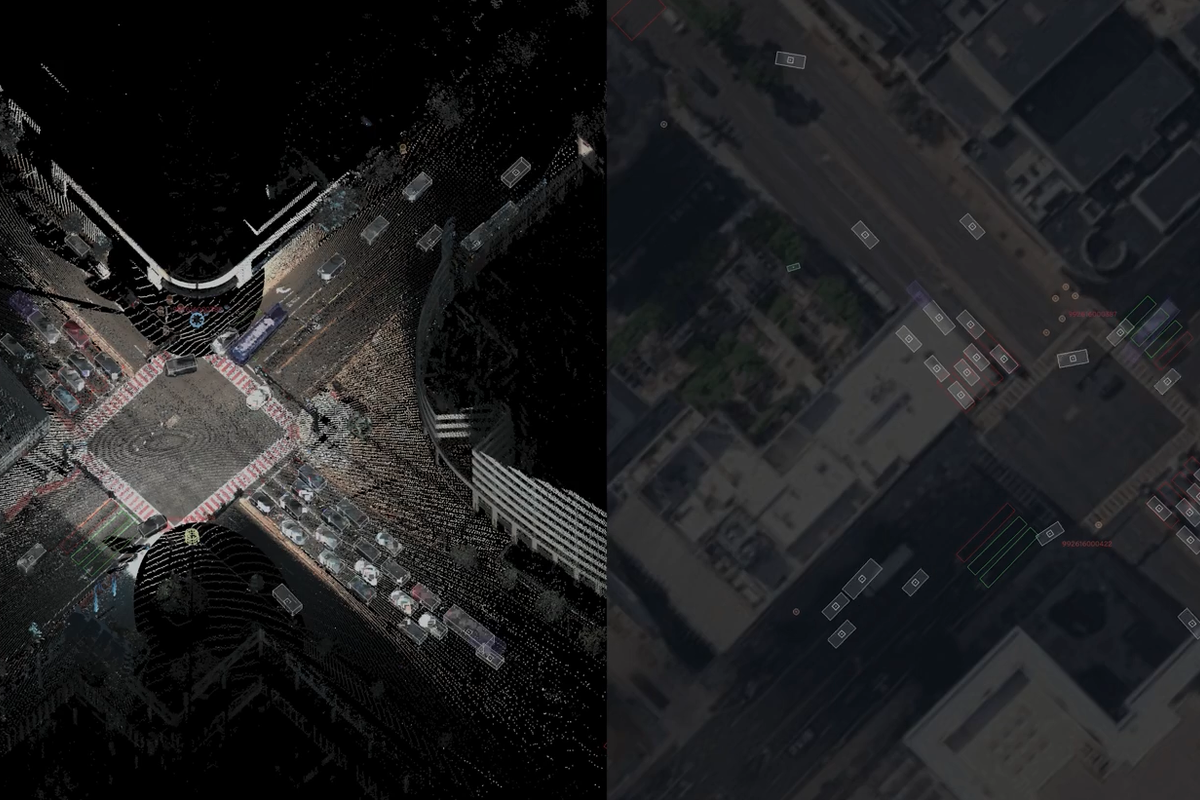
The World’s first native color lidar
ITS detection system
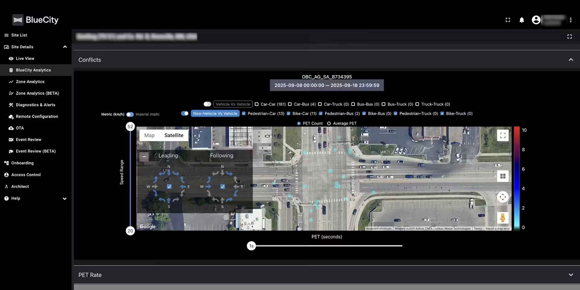
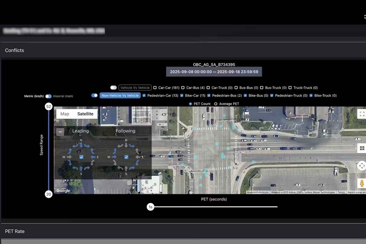
Capture color and depth to create high-fidelity digital traffic twins
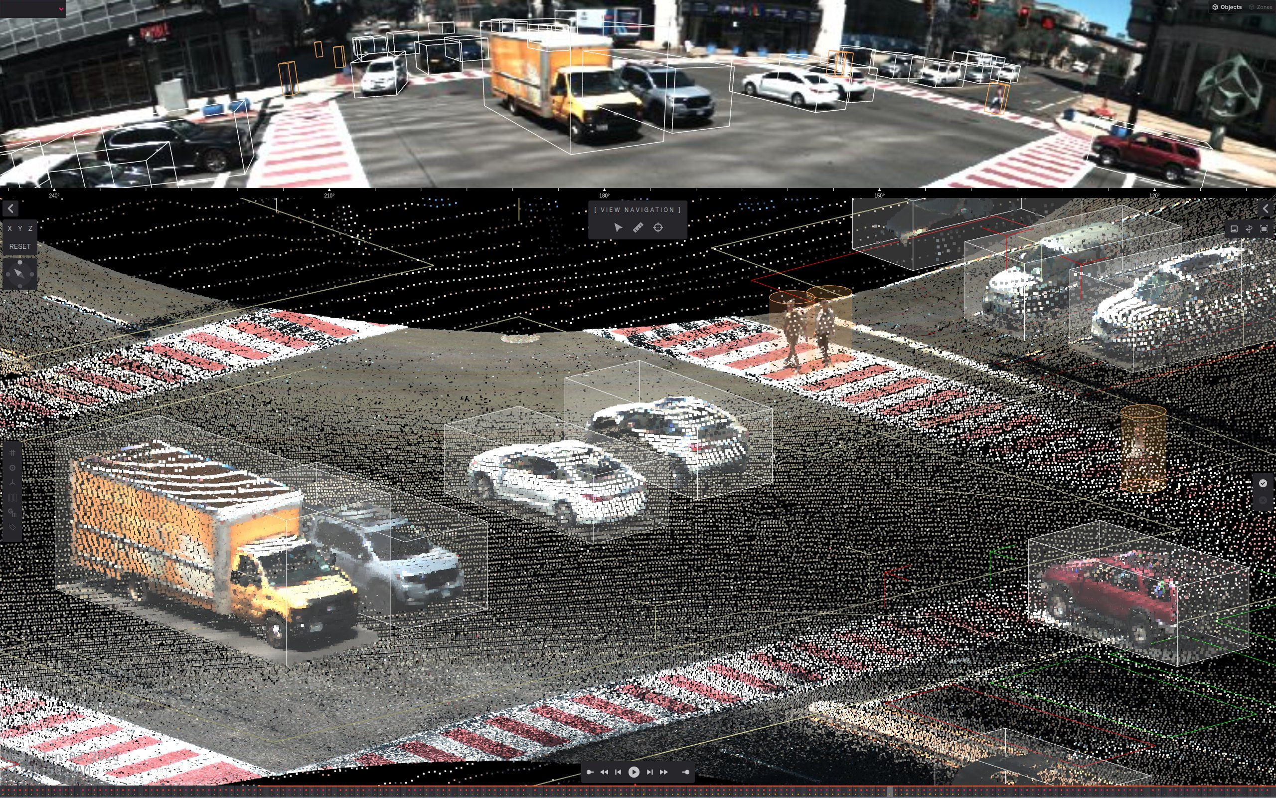
By capturing native color alongside longer multimodal detection range, our traffic teams gain unprecedented situational awareness to protect vulnerable road users and optimize signal timing along our busiest corridors.
Stephen FryczTransportation Manager, City of Stamford, CT
24/7
All-weather and light detection
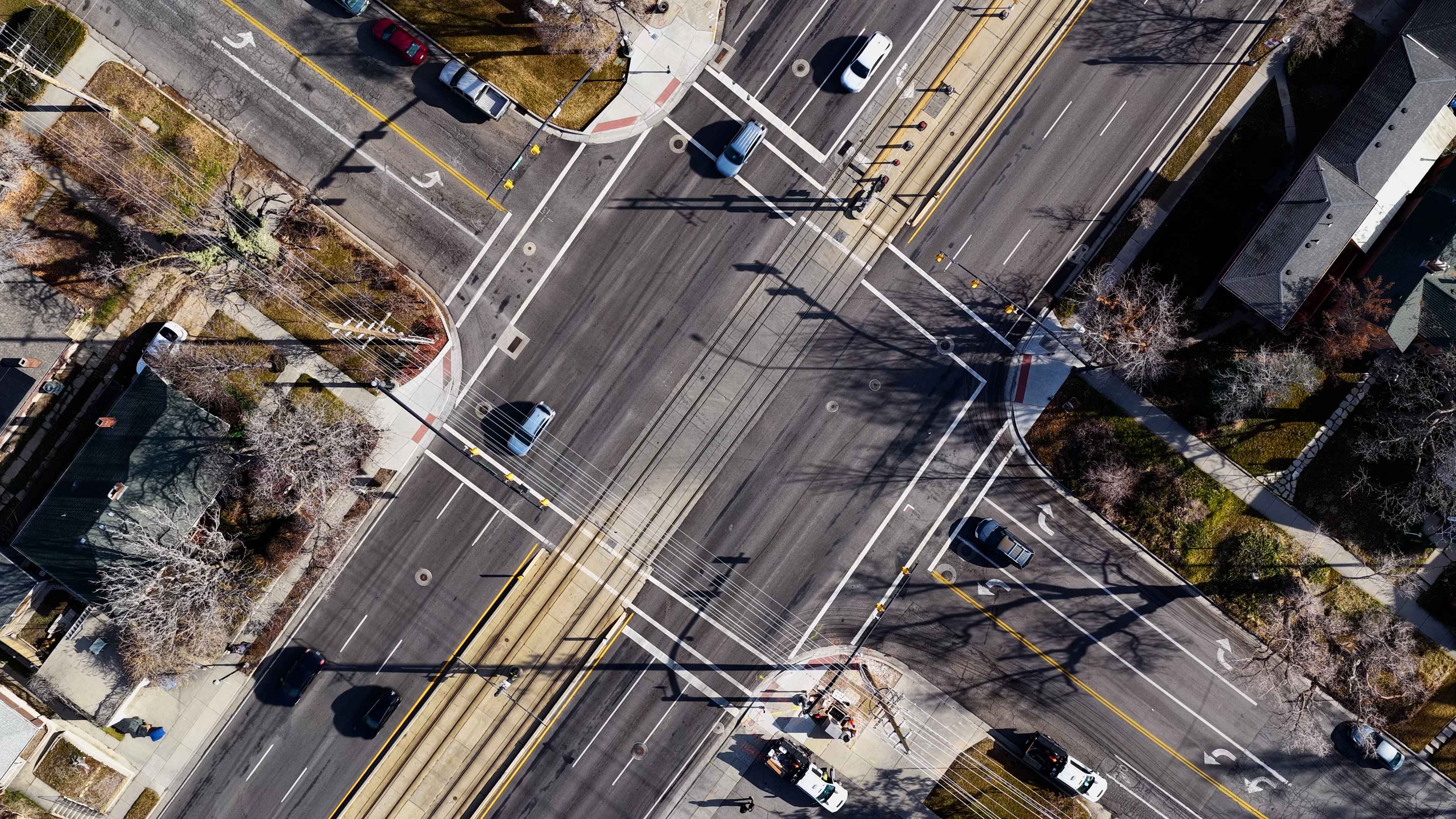
Up to 500 ft
360° long-range detection
Detect & Track
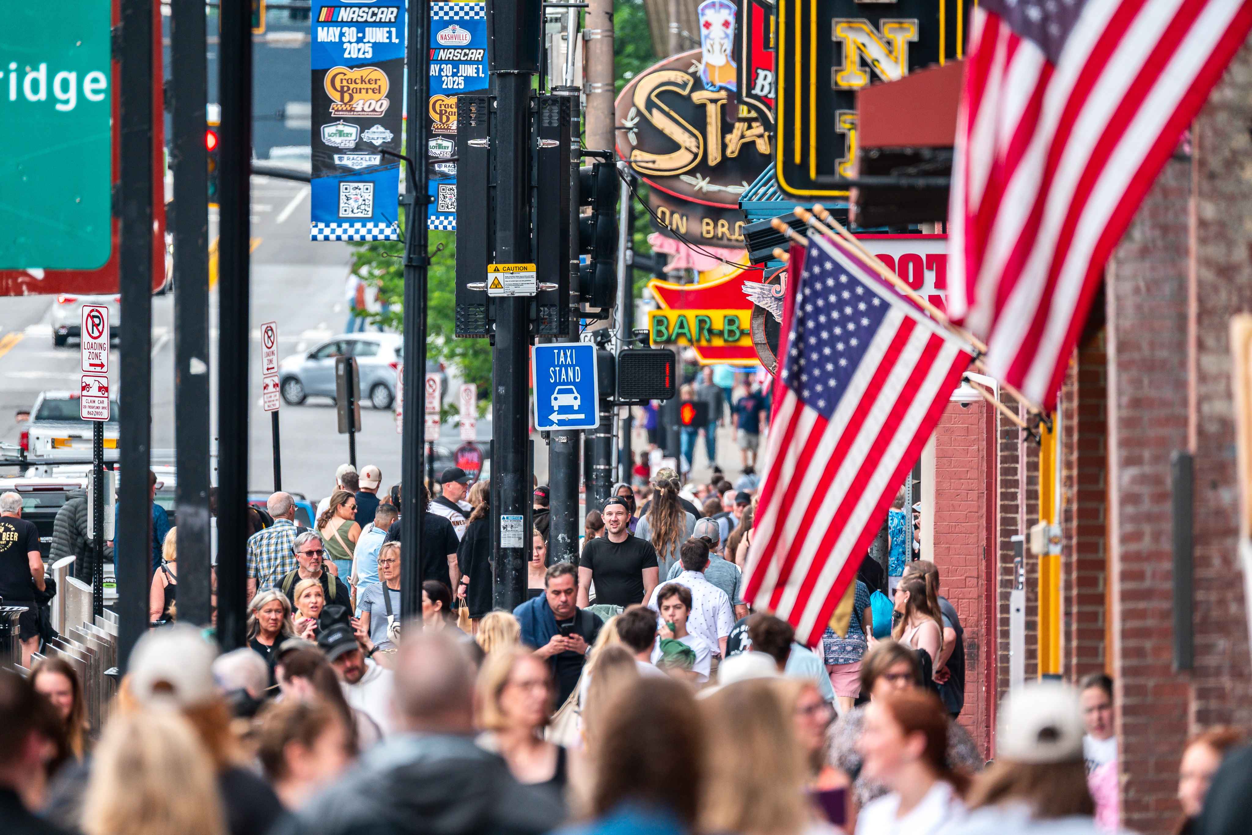
Pedestrians, cyclists, vehicles and trams
99%
Stop-bar detection accuracy
Open API architecture
For ecosystem integration and data sharing
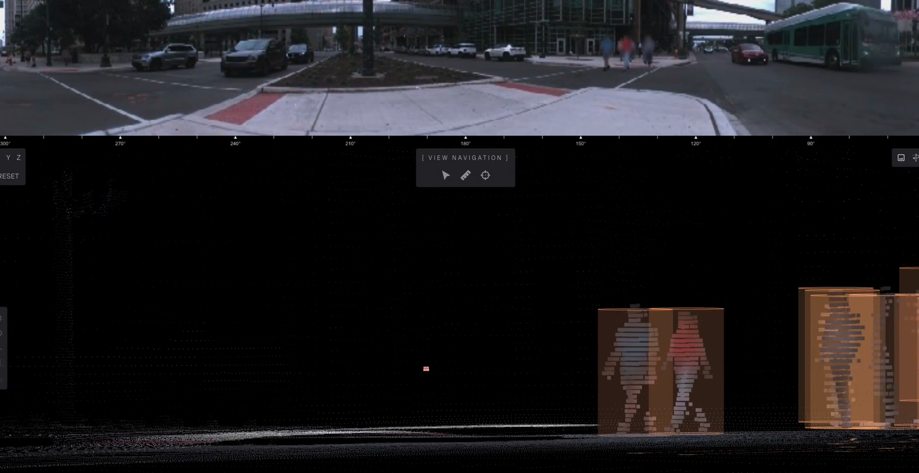
A system built with privacy feature technologies at the edge
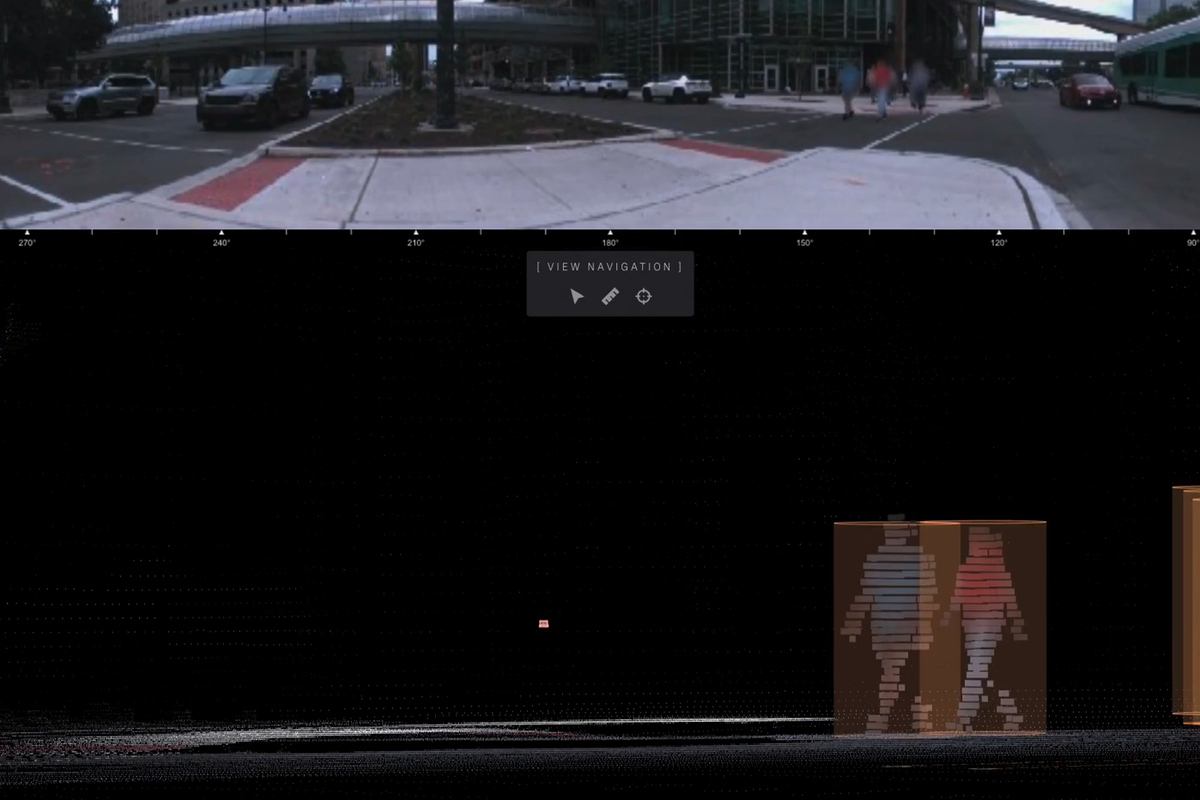
Ouster BlueCity provides real-time edge blurring of pedestrians and cyclists across both 3D and 2D visualizations, providing added privacy while retaining the high-fidelity color lidar data required for advance detection.
- System-level pedestrian and cyclist blurring
- Applies to 3D and 2D visualization
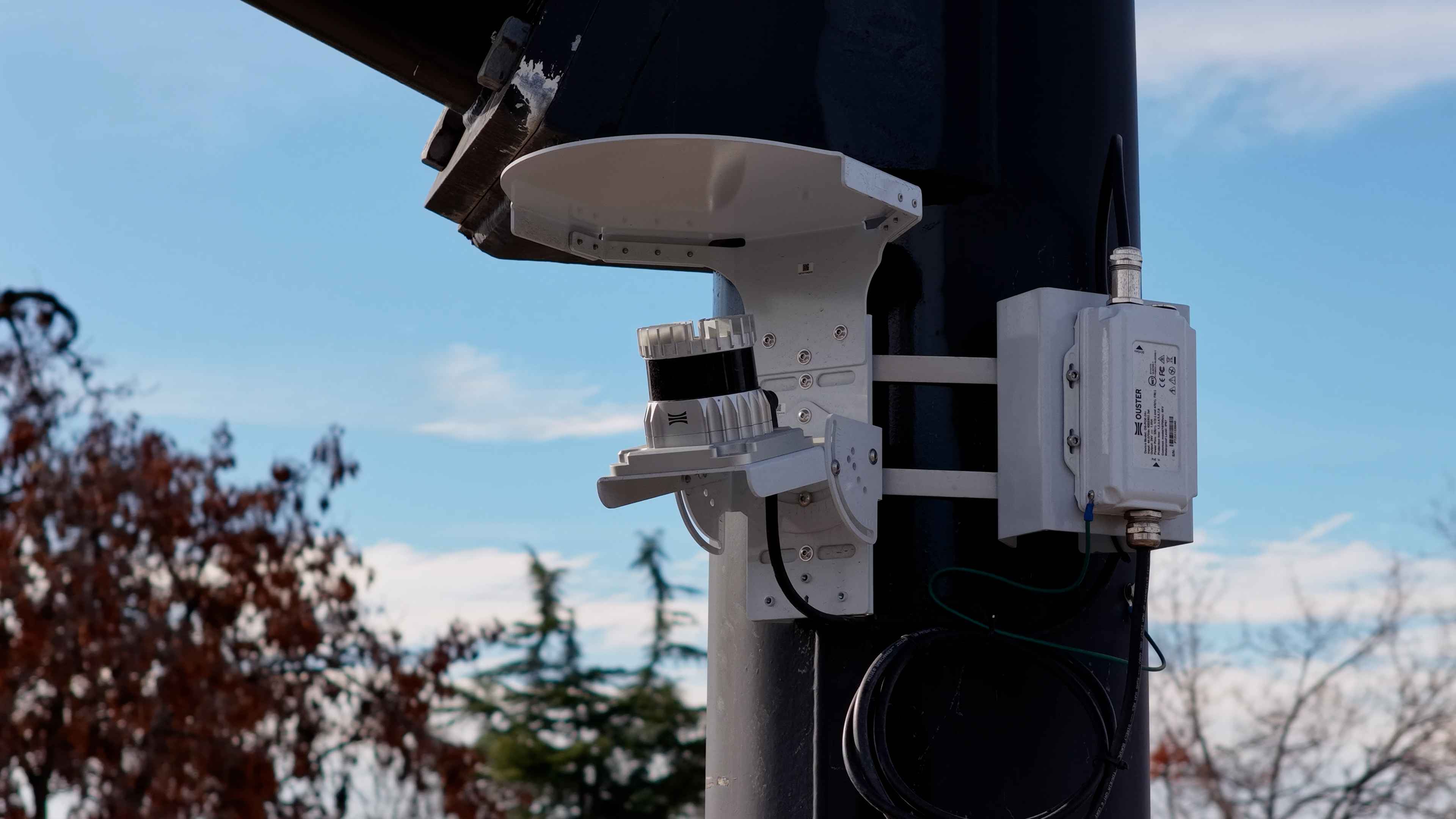
A complete system for all your detection needs
A consolidated hardware, software and analytics stack that does the job of multiple cameras, radars and inductive loops.
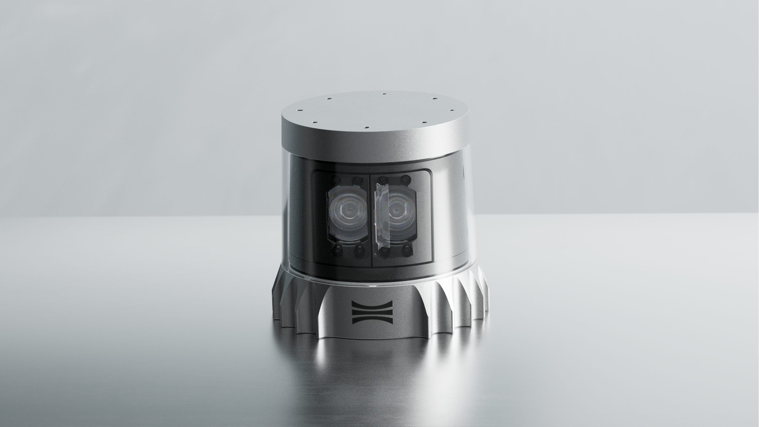
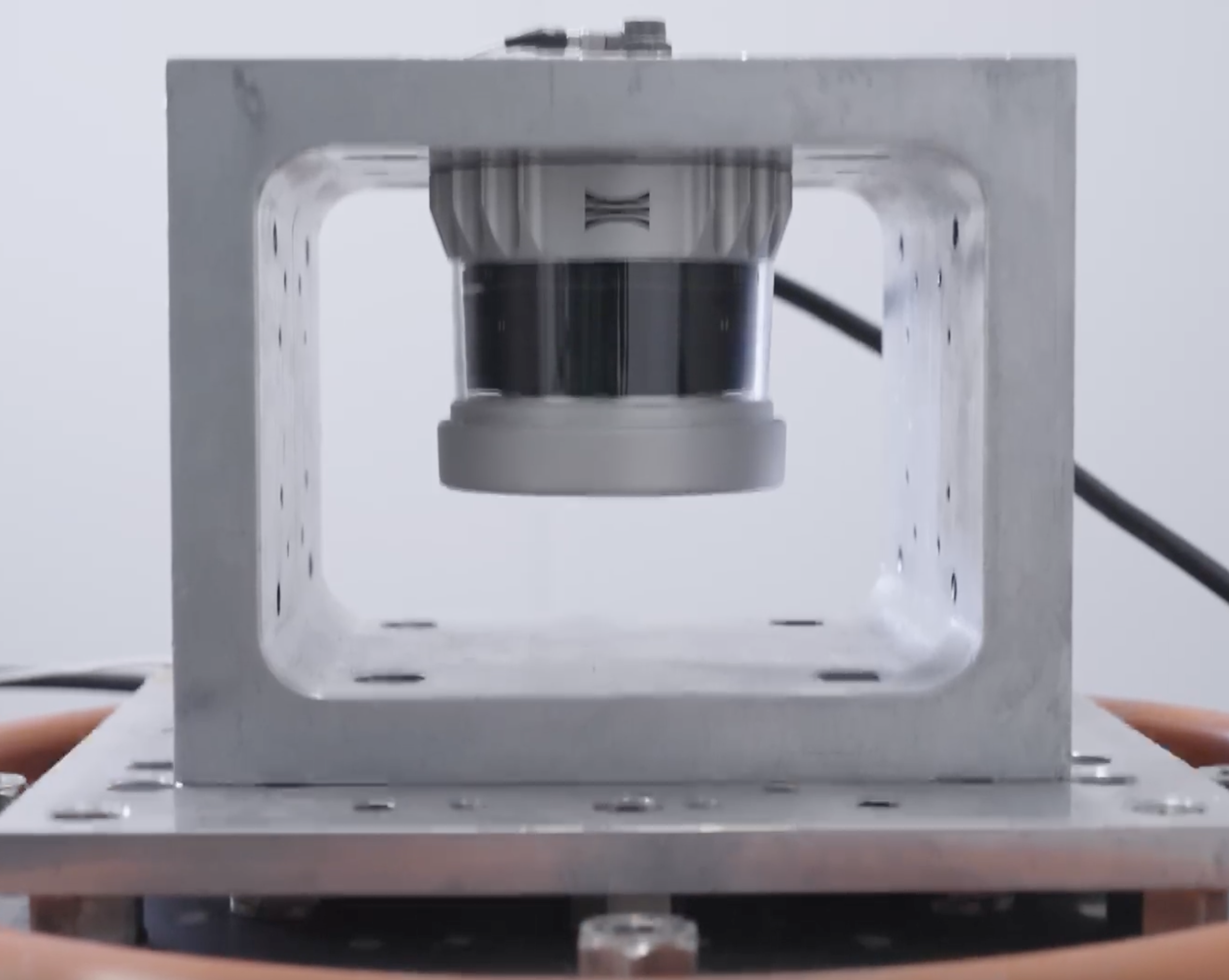
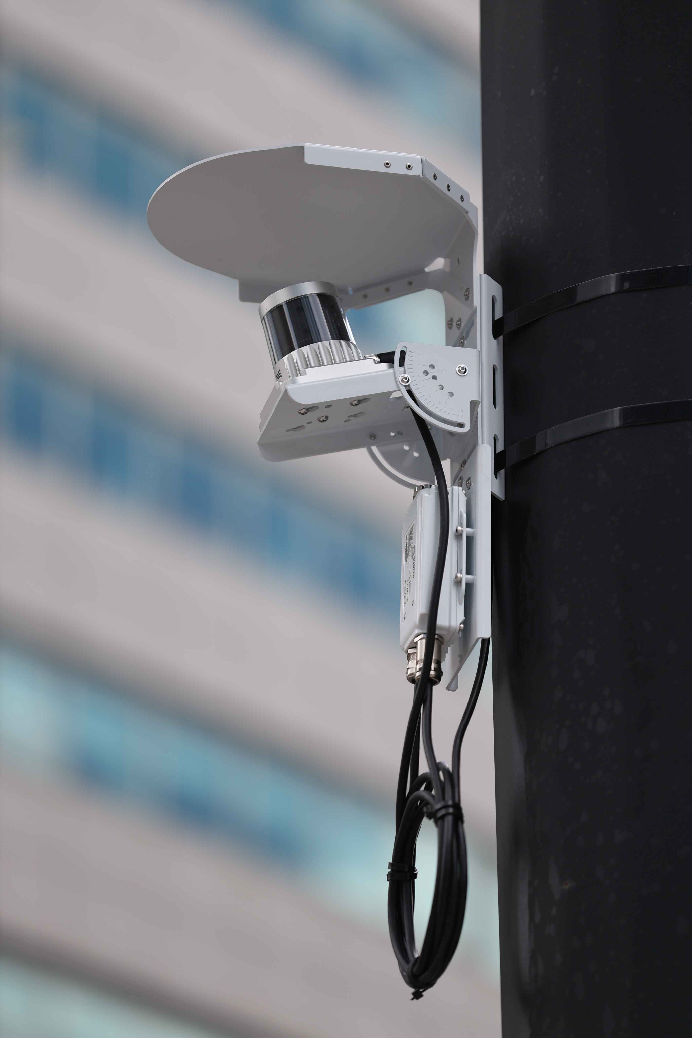
OS1 Max
The long-range Rev8 OS1 MAX delivers industry-leading price, performance, and automotive-grade reliability for the most rugged conditions.
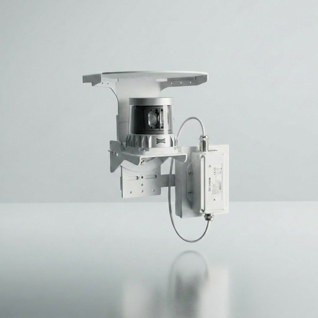
Edge detection, AI software
& accessories
Includes local hardware, software, and mounting components for a complete, field-ready system installation.
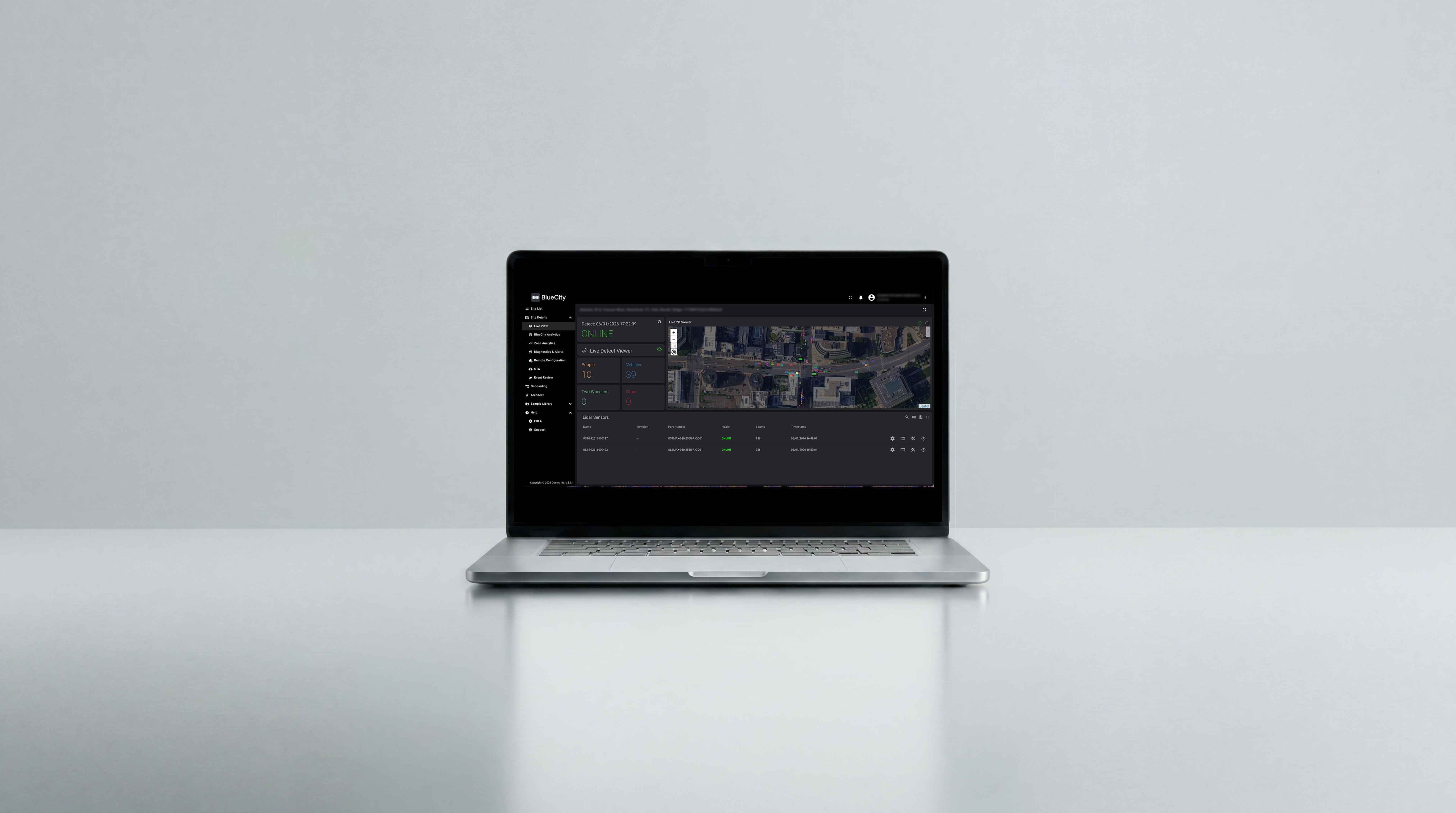
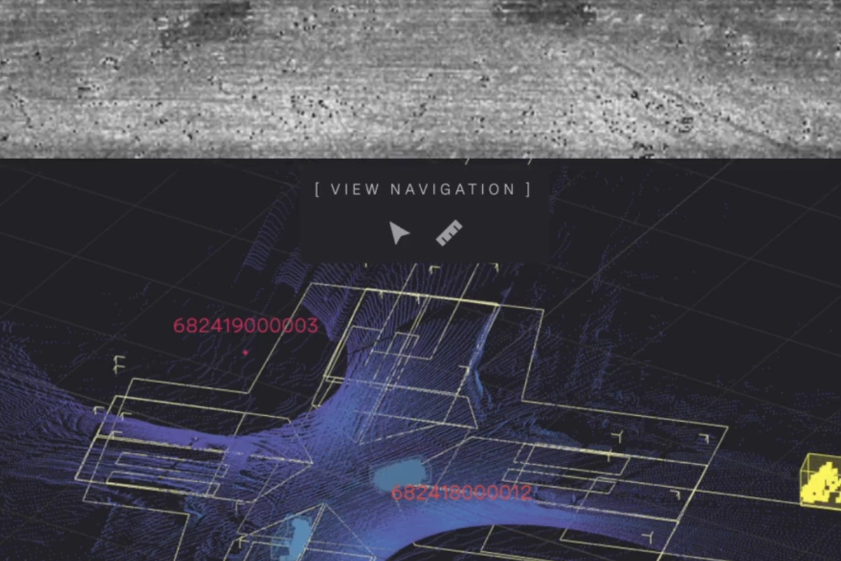
Ouster BlueCity Portal
Centralized cloud-based interface to configure, manage, and monitor Ouster BlueCity deployments around the clock.
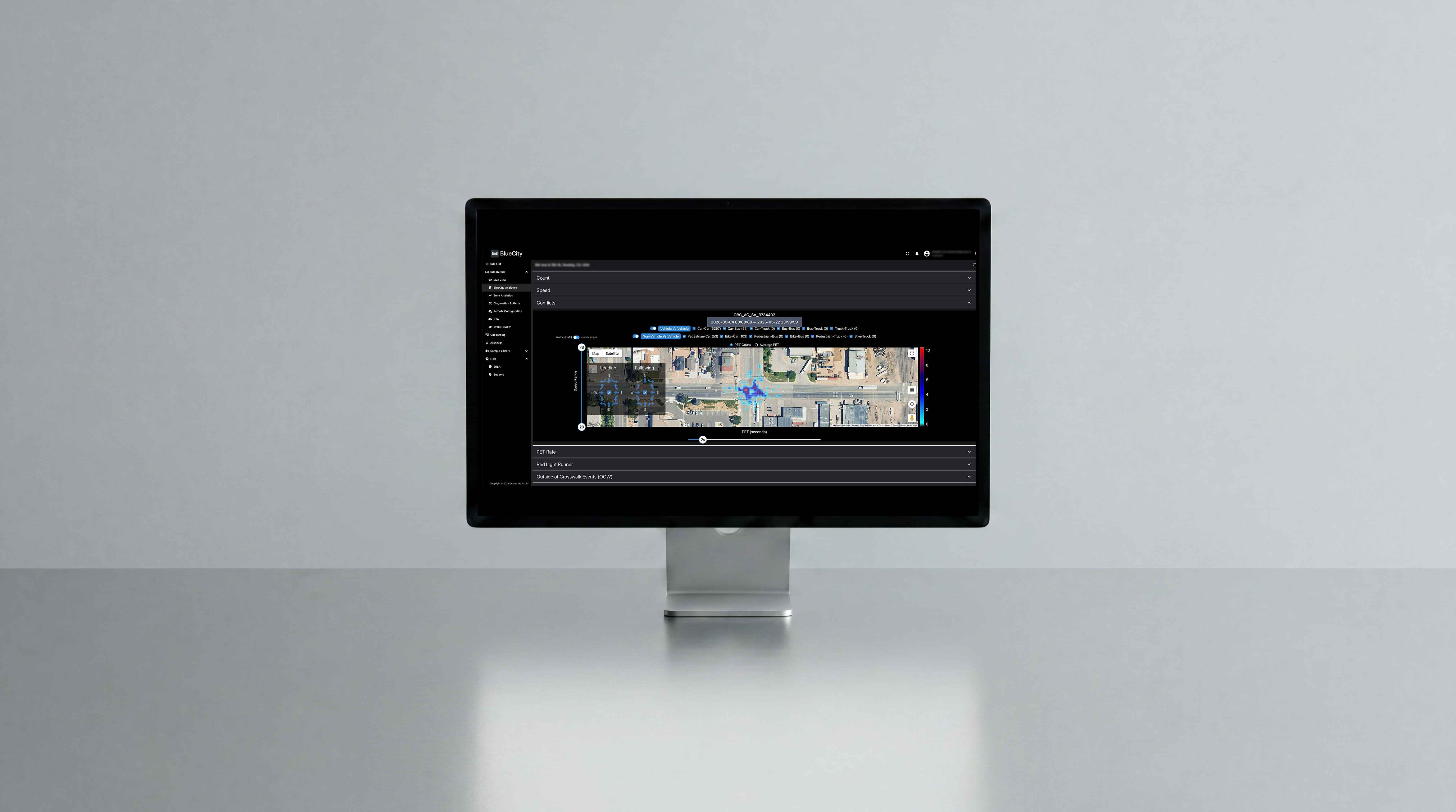
Edge & Cloud analytics
Access advanced analytics through a perpetual or scalable SaaS license, including data visualization and historic event recordings.
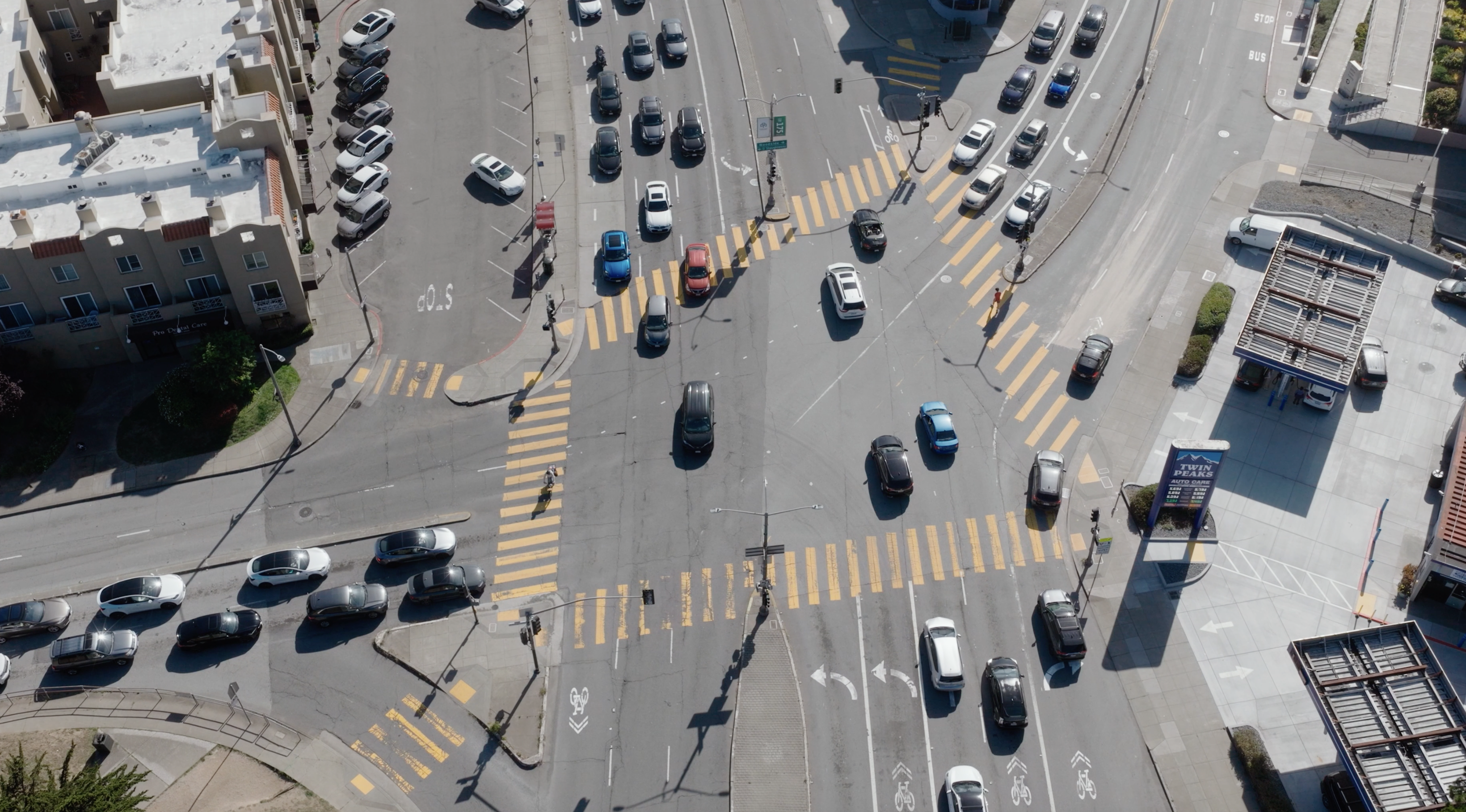
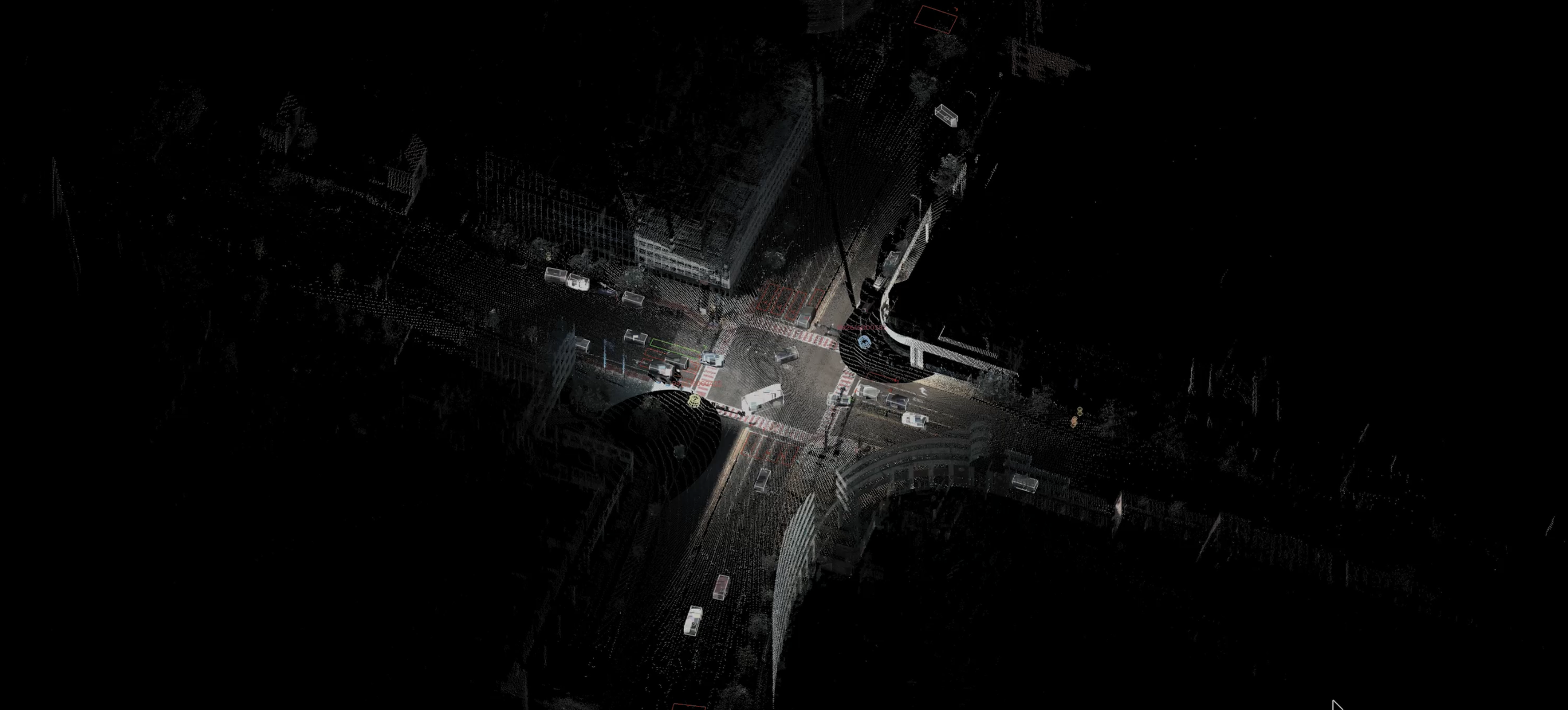
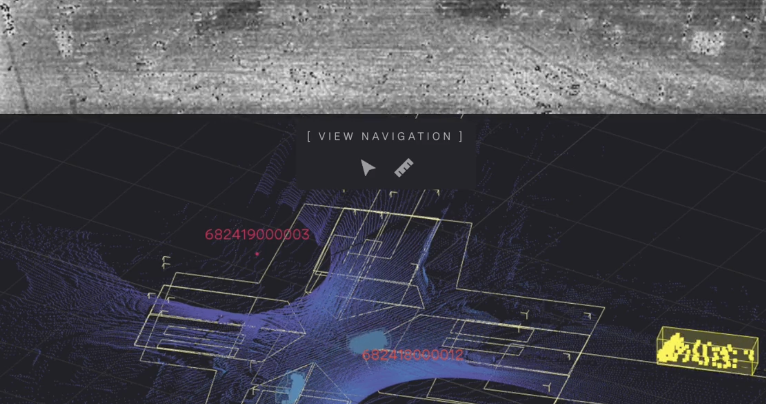
View real-time digital traffic twins of your intersection and roadways
Transform your traffic infrastructure into a live, high-fidelity data asset.
Ouster’s high-resolution digital lidar sensors continuously scan the roadway, collecting up to 10.4 million data points per second. When combined with proprietary AI software, this dense point cloud is transformed into a high-fidelity 3D digital traffic twin.
Comprehensive intersection and highway traffic management.
- Multimodal detection & tracking for dynamic signal actuation
- Two lidar sensors per intersection
- Traffic controller integration (NTCIP & SDLC)
- Corridor-level intelligence
- Performance & safety analytics
- Real-time V2X safety messages over RSU
Reliable, simplified solution for long-term value
Engineered for the harshest roadway environments, Ouster BlueCity delivers uninterrupted performance in all weather and lighting conditions.
Supports long-term program stability with a planned 10-year production life for operational certainty and investment protection.
250K+ hours MTTF
Industry-leading sensor reliability for long-term deployments and value for money
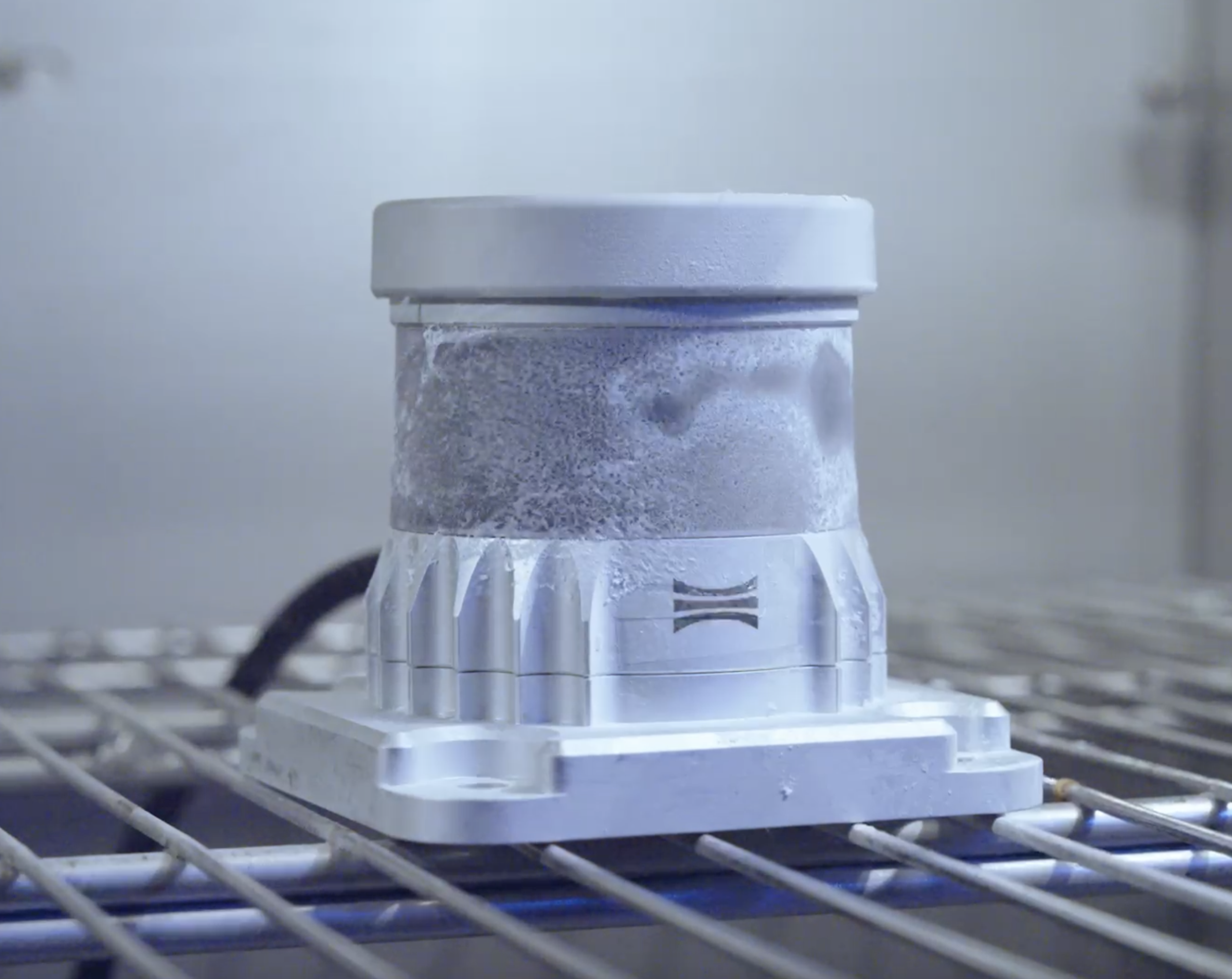
-40°C to +85°C
Rugged sensors built to withstand extreme environmental conditions
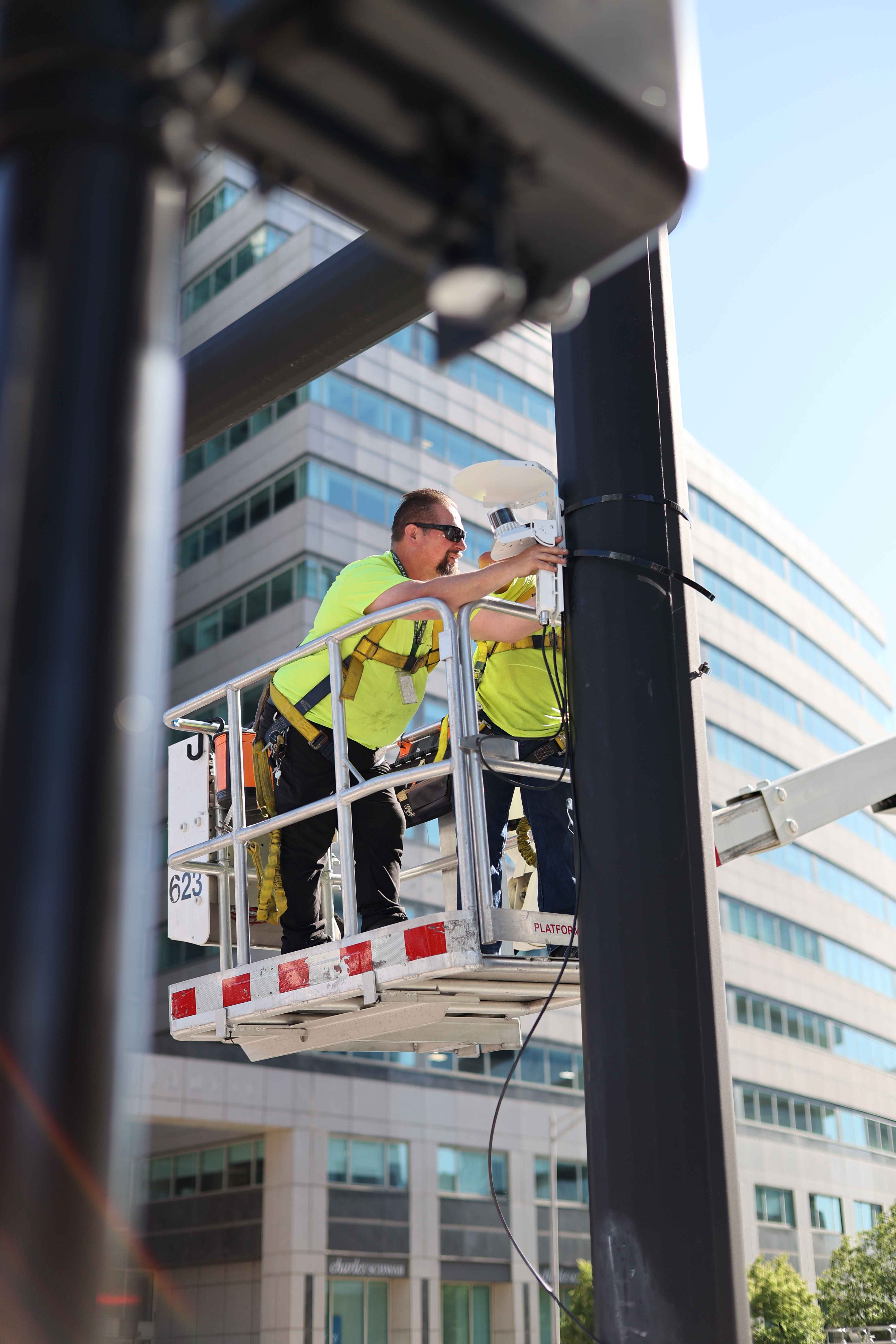
3-5 Hour Install Avg
Non-invasive, minimizes the need for mast arms, trenching, and lane closures
Low Maintenance
No complete calibration or frequent cleaning that leads to frequent field service dispatches
"During one of the worst blizzards the state has seen in decades, Ouster BlueCity’s detection performance remained flawless. It’s rewarding to provide a solution that maintains reliability when visibility is at its worst."
-Giovanni Vecchiarino, New England Traffic Solutions
Slash installation times and maintenance costs
- Fast 3-5 hour average installation
- No mast arms or trenching
- Limited lane closures
- No complex calibration
- Low maintenance costs
- No frequent cleaning
- No regular field service dispatches
Trusted and field-proven
A trusted and proven solution to meet the requirements of municipalities and transportation agencies
700+
Contracted intersection & roadway deployment
Top 3
Largest ITS lidar deployments in the U.S.
#1 Ranked
Overall lidar system score by Utah DOT Committee
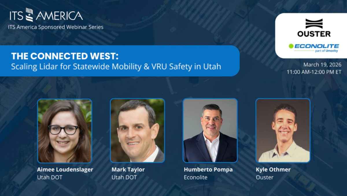
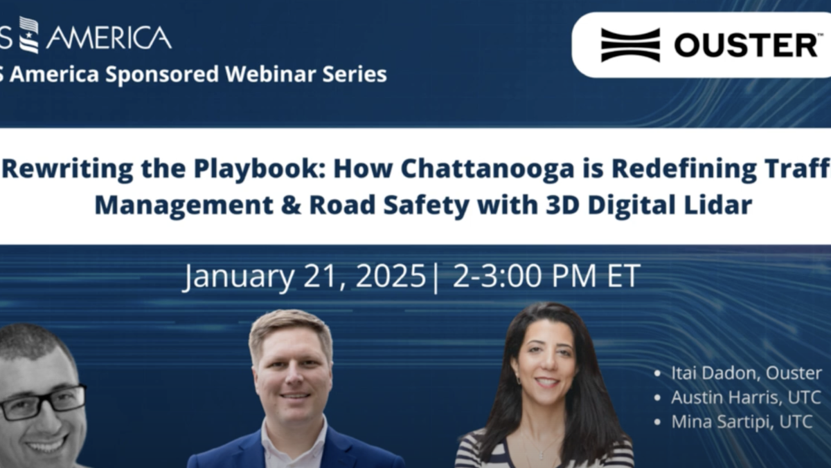
Ouster BlueCity in action

Learn why the city of Chattanooga, Tennessee, expanded Ouster’s BlueCity to over 120 intersections, making it one of the largest deployment of lidar detection technology for traffic and pedestrian safety in the United States.
Ouster BlueCity Portal
Centralized local and cloud interface to configure, manage and view deployments and analytics across multiple sites.
Now with improved native color situational awareness for simplified zone set-up and more intuitive event recording analysis.
- Edge (local) or cloud access
- Live 3D digital traffic twin visualization with optional native color point cloud and 2D image
- Remote configuration
- Event recordings and analytics review
- Diagnostics and system health
Meet our network of ITS distributors
Connect with our premier ITS distributor network to secure seamless localized deployment and expert regional support, backed by 98% North American partner coverage and an expanding global footprint.
Are you ready to get in-touch?
Connect with our team to learn how Ouster BlueCity can optimize your traffic operations, improve road user safety, and deliver actionable insights across your network.