Ouster Gemini Perception & analytics
A new kind of core spatial intelligence lidar software that accurately detects, classifies, and tracks people, objects, and vehicles for actionable, intuitive, and tailorable insights. Purpose built for those working in traffic, security, crowd, and retail management and analytics.
Technical Specifications & Details
- Perimeter security, keep-out zones, and real-time alerts
- Outdoor monitoring for fences, gates, and open sites
- Detects objects as small as a hand with near-zero false alarms
- Weather- and lighting-agnostic active sensing
- Inherently anonymized — no faces, no license plates
Surpassing Industry Standards

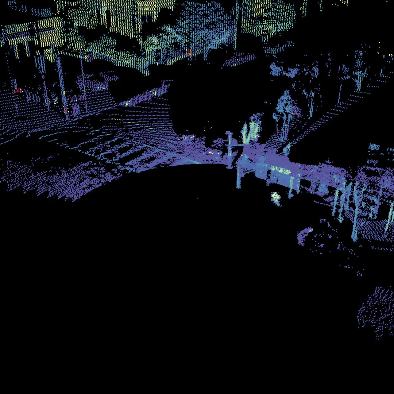
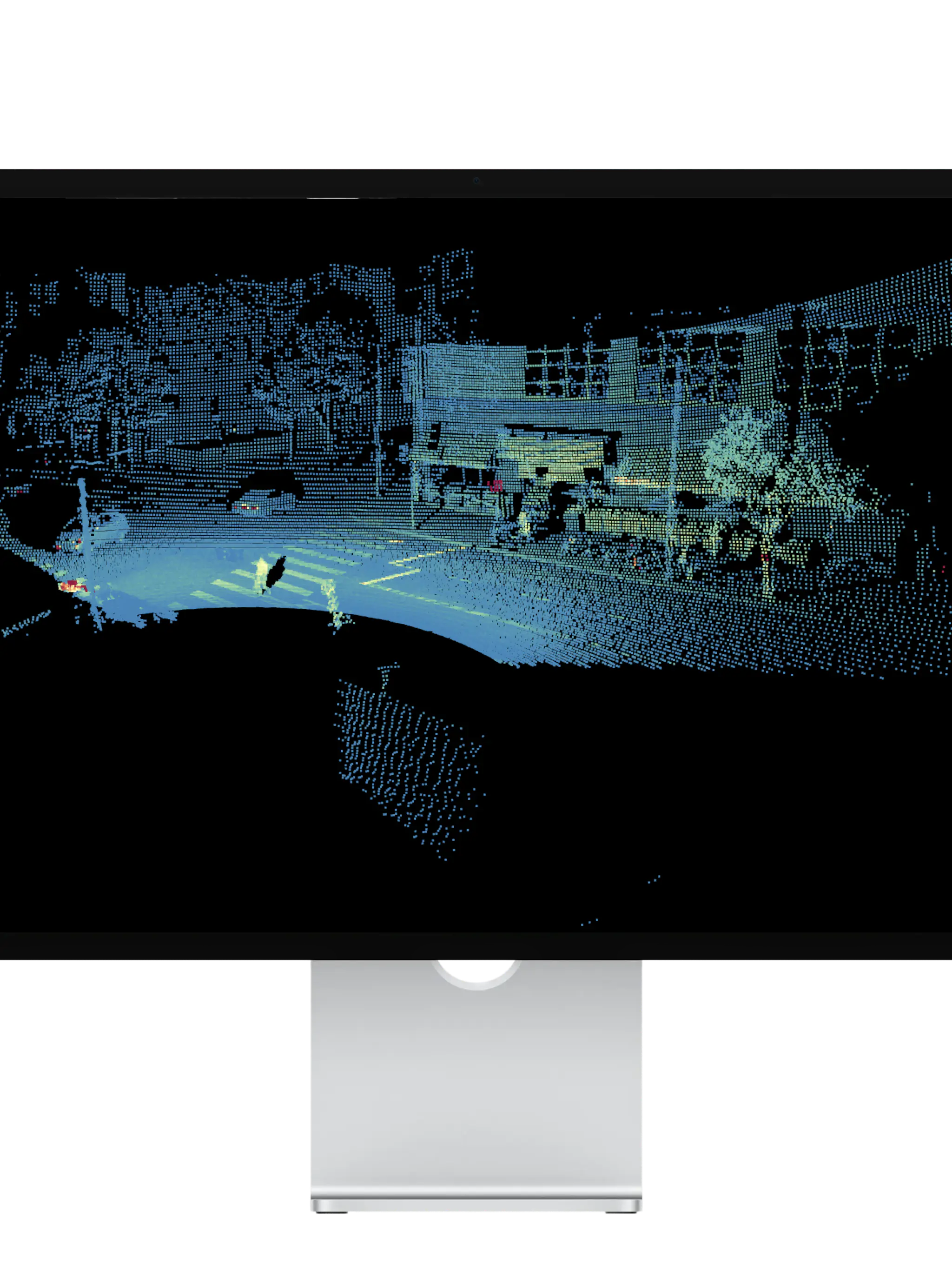
Direct 3D measurement, not inference. Gemini tracks objects with centimeter-level precision and holds that accuracy at the edges of every detection zone.

What's included?
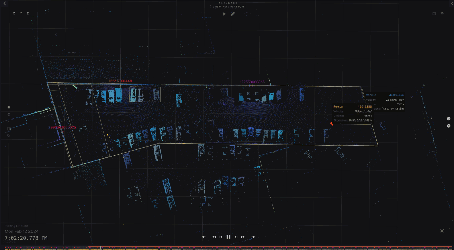
Ouster Gemini is the brain for our digital lidar. The platform includes the perception engine, automated multi-sensor merging, a WebGUI for setup and live 2D/3D visualization, a system diagnostics dashboard, custom event zones, OTA updates, and a cloud portal for managing every site from one place.
Applications
Partnering with Industry leaders to deliver cutting-edge hardware solutions

Digital Mortar and Global Partners
In their project with the Global Partners retail chain -- Alltown Fresh -- Digital Mortar uses Ouster Gemini and Ouster OS sensors to provide highly accurate and actionable data and insights regarding user journeys and shopper analytics. Based on the data collected, Global Partners is able to optimize their current layouts and the future designs for all their locations to ensure optimal business outcomes and customer experience.

Open Space and Avanti West Coast Rail, UK
With an emphasis on proactive station management and creating a link between engineers, architects, and end-customer experience, Open Space and Avanti West Coast Rail are transforming the way the UK rail network is managed.

SafeHaus pairs Ouster Gemini with a decade of crowd intelligence to proactively keep events safer
SafeHaus uses Ouster Gemini to turn entire festival sites into a single, continuous 3D map — delivering square-meter-level crowd density tracking, sub-100 ms safety alerts, and privacy-first monitoring at the world's largest live events.
Digital Mortar and Global Partners
In their project with the Global Partners retail chain -- Alltown Fresh -- Digital Mortar uses Ouster Gemini and Ouster OS sensors to provide highly accurate and actionable data and insights regarding user journeys and shopper analytics. Based on the data collected, Global Partners is able to optimize their current layouts and the future designs for all their locations to ensure optimal business outcomes and customer experience.
Open Space and Avanti West Coast Rail, UK
With an emphasis on proactive station management and creating a link between engineers, architects, and end-customer experience, Open Space and Avanti West Coast Rail are transforming the way the UK rail network is managed.
SafeHaus pairs Ouster Gemini with a decade of crowd intelligence to proactively keep events safer
SafeHaus uses Ouster Gemini to turn entire festival sites into a single, continuous 3D map — delivering square-meter-level crowd density tracking, sub-100 ms safety alerts, and privacy-first monitoring at the world's largest live events.