


The US government recently passed a $1.2T infrastructure spending bill, which will lead to massive investments in new connected infrastructure. This type of spending is exactly what we think of when we discuss government spending on infrastructure, and rightly so. In 2017 alone, infrastructure capital spending in the US totaled $174B.
But what if I told you that this wasn’t the biggest infrastructure related expenditure that year? While building new bridges, laying new cables, and repaving our roads get the most air time, the biggest infrastructure expenditures are the operation and maintenance of our infrastructure we have already built. In 2017, the same year the US spent $174B on new infrastructure, the US also spent $266B just to operate and maintain the infrastructure we have – 50% more money is spent on infrastructure operations and maintenance than new infrastructure construction.
With millions of miles of roads, pipelines, and cables to keep track of, industry operators have struggled to keep their assets in working shape, leading to catastrophic events like the failed power lines that caused the massive Dixie wildfire in California. A key emerging technology in the space of infrastructure operation and maintenance is 3D mapping. With 3D mapping, infrastructure operators can take frequent 3D scans of their assets to determine where trees are growing into power lines, where roads have potholes, or where pipelines have cracked. These scans can be used for a single inspection, or as a regular maintenance tool to generate what is called a ‘digital twin’ of the physical world.
Digital twins are a relatively new concept, but 3D scanning and inspection methods have been around for decades. Traditional scanning methods are time consuming, expensive, and hazardous for operators in some locations. These methods often interfere with construction sites or the public’s use of infrastructure, during the data collection process. In addition to these pitfalls, conventional mapping uses highly specialized equipment and software. Operators need weeks of training and experience to safely and effectively use the equipment. The high cost, time commitment, and required skill have created a significant barrier for companies or municipalities that want to create a digital twin of their infrastructure, or survey their new construction site. This has slowed the adoption of infrastructure mapping across industries and has prevented outsiders from benefiting from digital twin inspection or site surveying.
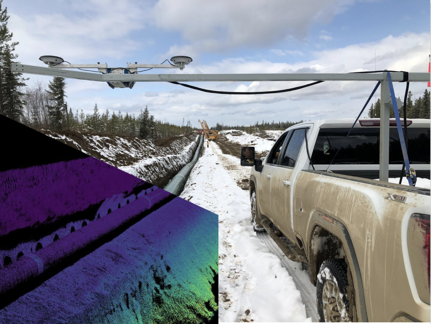
Lux Modus was founded with the vision to eliminate these barriers. Lux is a remote sensing company, founded in 2017, that is disrupting the industry with their LuxGear 3D mapping platform. The LuxGear mapping platform is lightweight, cost-effective, easy to use, and more accurate than traditional methods, saving their customers both time and money.
The LuxGear Platform
LuxGear is a user-friendly remote sensing platform that is designed to collect data, process, and produce digital twins in some of the harshest environments. Users are able to mount the platform on a vehicle or any moving object traveling up to 60 mph. The platform is both mobile (functional at speeds up to 60 mph) and ruggedized for rough terrain and extreme temperatures (-35 ℃ to +45 ℃). Once a user has collected the data, they simply upload it to LuxCloud and have a fully processed visual representation of the environment within minutes. This technology drastically reduces the cost and time required for 3D data collection. The easy-to-use and affordable nature of Lux Modus technology has allowed municipalities, construction managers, and asset management companies to have detailed 3D data that previously was not an option.
Leveraging near-infrared data
After thorough research and development for the LuxGear platform, Lux Modus decided to use Ouster digital lidar as the primary sensor in their sensor suite. Ouster’s industry-leading reliability, IP68/69K rating, and small lightweight form factor were important features for Lux’s decision to integrate, but the key difference-maker for Lux was the additional data layers that Ouster lidar sensors provide. While most lidar sensors provide only range data, and sometimes reflectivity data, all Ouster sensors output: range, signal (intensity), reflectivity, and near-infrared data (“NIR”).
The NIR data is specifically unique to Ouster and is not provided by any other type of lidar sensor. Ouster sensors collect photons from sunlight that are reflected off of objects in the surrounding environment, just as a camera would. This produces a camera-like data layer that can be used to read signs or spot detailed attributes that are lost in a typical point cloud. With a background in imagery remote sensing digital signal processing, Lux’s team immediately saw the value of the NIR data. Lux believes that lidar processing should advance along the same path as traditional satellite and aerial remote sensing, where more attributes per pixel will enable more object detection, feature extraction and even calibration. Just as multispectral imagery gave rise to NDVI (or Normalized Difference Vegetation Index) analysis for agricultural and other industries, Lux is confident that near-IR, and other digital signatures will contribute to automated object analysis and more detailed 3D mapping.
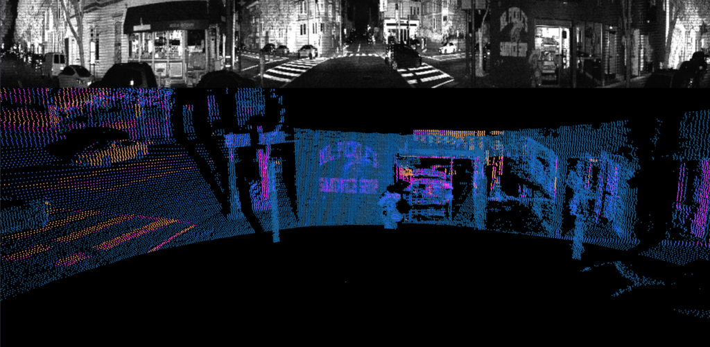
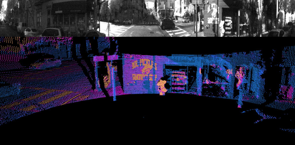
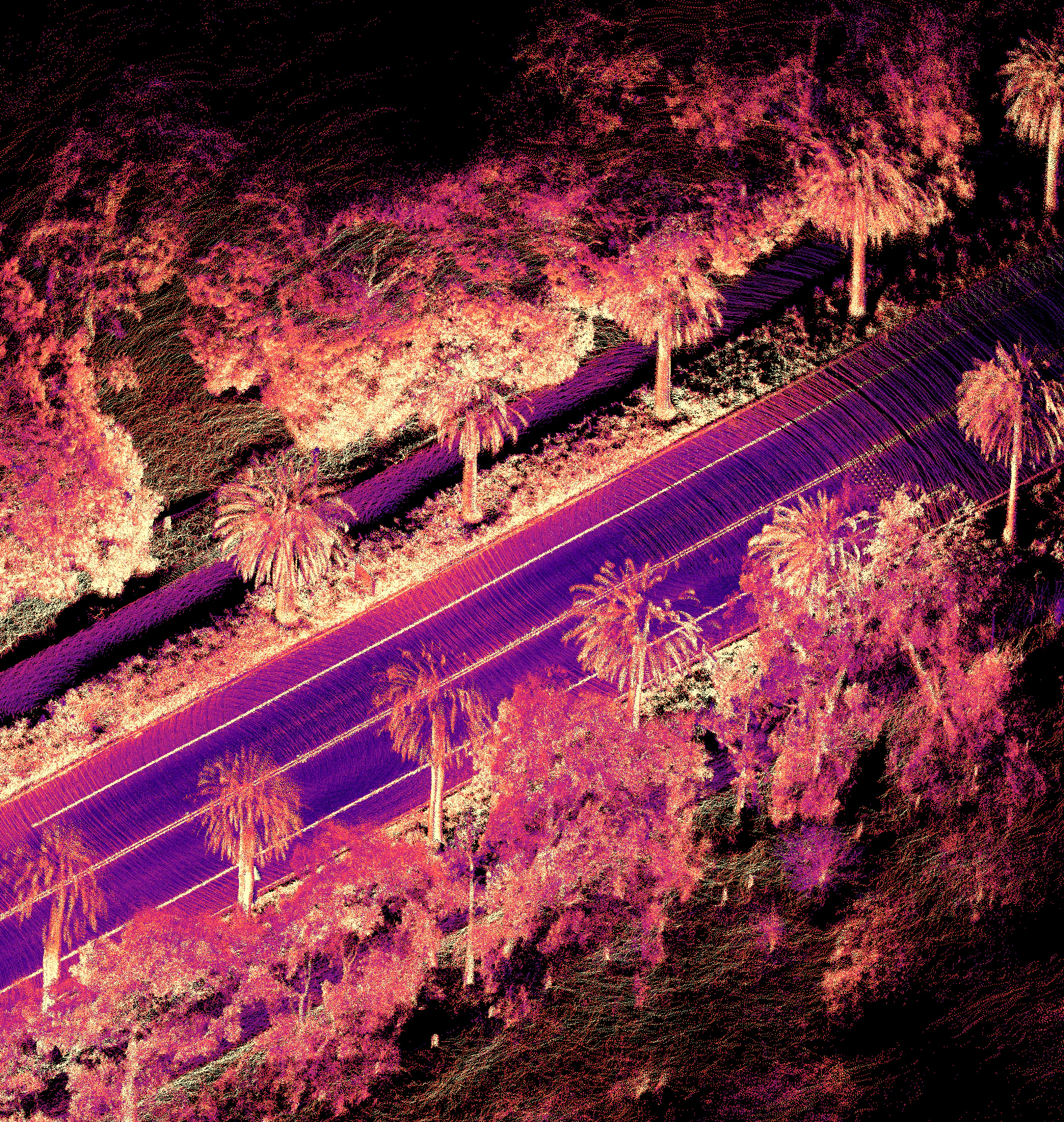
The two images below demonstrate the value in these additional layers of data. The first image shows the signal channel- light returned to the sensor from the photons it transmits into the environment. This is a common data layer amongst many lidar manufacturers. The second image demonstrates the near-IR channel- light from the sun that is reflected from objects and collected by the sensor. This data layer is one of the very unique pieces of data that Ouster’s digital lidar provides.
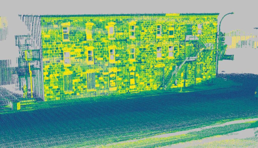
Lux uses the NIR data in their advanced processing. This extra layer of data provides additional attributes of the environment being scanned, such as reading road signs, paintings on the asphalt, and identifying sections or welds on pipelines. The picture below demonstrates how these additional data layers can be used to detect different surfaces on a brick building.
As stated by Lux Modus president, Joseph Hlady, “In designing our technology, we chose Ouster for several reasons. The two main reasons were Ouster’s industry-leading reliability and their ability to provide additional data layers, such as near-IR and calibrated reflectivity. In infrastructure management and construction surveying, these extra parameters from each pixel allow us to provide additional information about road signs, materials, dampness, and reflectivity. Combining this with our RGB values, we have opened the door to countless feature extraction capabilities. Delivering a robust, digital twin with far more detail than current methods.”
A partnership for advancement
This is just the beginning for Lux Modus and Ouster. Lux will continue to improve upon their breakthrough platform and leverage the performance improvements that digital lidar will deliver for years to come. This will continue to improve mapping and surveying. If you’re interested in learning more about the unique data layers Ouster provides, please check out our blog here. If you would like to get in contact with Lux about their solution, please feel free to contact them here.
Related Articles

Built to last: Why Ouster BlueCity is a rugged and reliable choice for ITS deployments
Defining a New Era of Durability in ITS
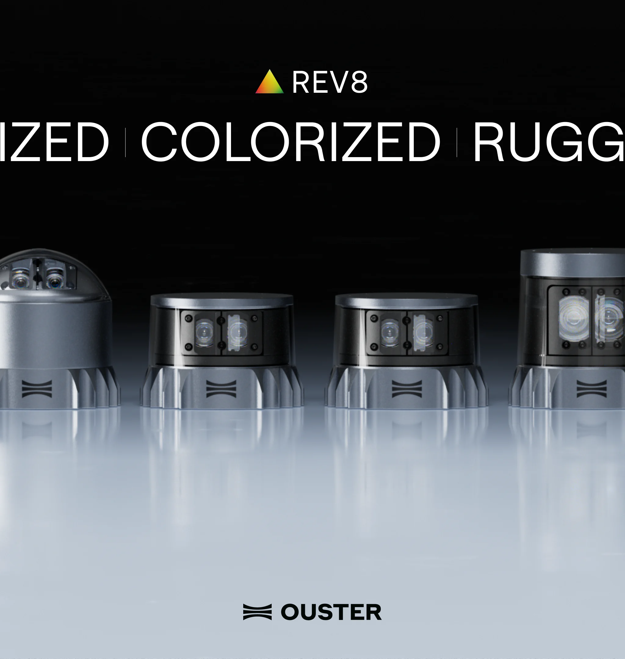
Introducing the REV8 OS Family: The World’s First Native Color Lidar
A new generation of Ouster digital lidar, powered by custom L4 Ouster Silicon. Rev8 introduces native color lidar, provides up to double the range and resolution, and is designed for functional safety, reliability, affordability, and scale.
Freie Universität: High-Precision, Small-Footprint Mapping
Researchers at Freie Universität Berlin are changing a storage paradigm for autonomous navigation. By using Ouster OS2 digital lidar to create ultra-lightweight bird's-eye-view maps, the team achieved sub-50cm localization accuracy with a map footprint of just 4 MB per square kilometer.