
Major city in Germany implements digital twin technology as part of Europe’s largest lidar infrastructure project
“Houston we’ve had a problem.”
During NASA’s Apollo 13 mission in the 1970s, three onboard astronauts suddenly heard a loud explosion that shook their voyaging spacecraft and severely damaged their vehicle. Meanwhile, the spacecraft continued to evolve due to the harsh, extreme conditions of space. All the failure scenarios and simulations the team had prepared for using the original digital model did not prepare them for this.
200,000 miles away, NASA’s mission controllers had to quickly adapt the digital model in order to run new simulations and bring the crew safely home. To match the real-time state of the spacecraft, the team used a continuous live stream of data and a combination of mathematical and physical models. With this “digital twin”, they ran simulations and tested new strategies with the onboard crew. Fuel was limited, oxygen was limited, time was limited – but the “digital twin” allowed NASA to quickly learn, adapt, and safely bring the three astronauts back home.
This concept of “digital twins” has revolutionized other industries as well, including manufacturing and engineering. Access to real-time representations allows for continuous innovation, quantifiable decision making, and cost savings of up to billions per year.
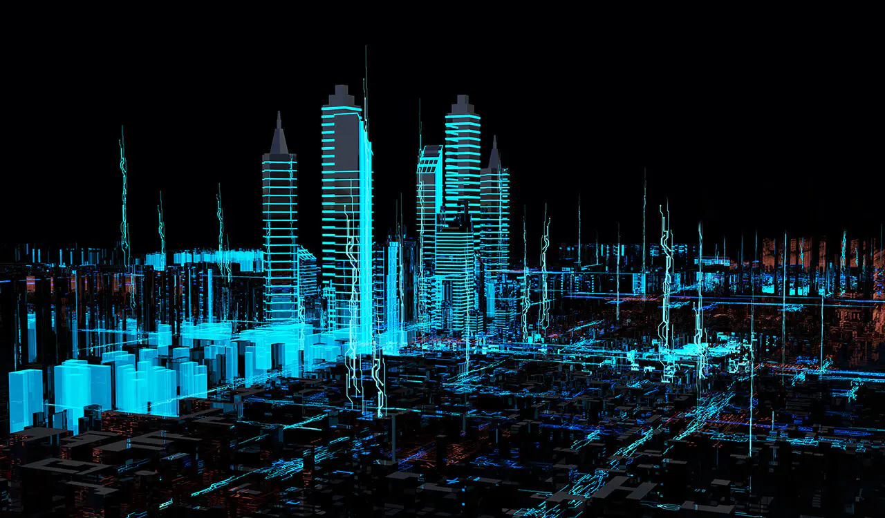
Today, “digital twin” technology is an increasingly important ingredient of smart cities. The digitization and bi-directional mapping of the real and the digital worlds are key to planning the future of efficient and safe mobility. And it starts with having precise, detailed data.

In this post, we’ll cover the potential smart cities applications of digital twin technology and discuss how the City of Aachen is building digital twins with Ouster digital lidar as it prepares for V2X deployments.
Interested in learning more about how Ouster lidar can help you build digital twins? Learn more about our lidar solutions for smart infrastructure or contact our team.
Digital twin vs. 3D model
A digital twin is not just a precise, high-fidelity 3D model, though a 3D model is certainly an important component of a digital twin.
What differentiates a digital twin from a model is the bidirectional flow of data between the physical and the digital world. This continuous synchronization of data enables digital twin models to be continuously updated based on real-time conditions, making it an effective tool to run virtual simulations and scenario planning.
As defined in this research study “Digital Twin: Origin to Future”, a digital twin has a few common characteristics:
- Ultra high-fidelity model of the physical object, often pulling from multiple data sources. The higher level of the detail and precision, the more it can be used as an effective and reliable tool. For example, smart cities may integrate infrastructure, vehicle movement, pollution, and demographics data.
- Dynamic, bi-directional mapping between the physical and digital world. A digital twin is essentially a living model in 3D and must account for both real-time and historical data.
- Self-evolving and self-adapting. The real world doesn’t stop evolving, and neither does a digital twin. A digital twin must self-optimize with the help of new sources of data collected in the physical world.

Digital twin technology is a key foundation for smart cities
Cities around the world have started to explore digital twins to accelerate applications, including:
- Urban planning. Running “what if” scenarios on digital twins enables city planners to evaluate the impact of proposed infrastructure developments and policy changes, aiding in the decision making process. For example, researchers could simulate how the construction of new bike lanes could impact bicyclist safety, traffic flow, curb parking, and even air pollution. Using a digital twin, planning can be done more effectively to optimize for safety, accessibility, cost, or other factors.
- Traffic management, including the integration of connected and autonomous vehicles. Similar to urban planning, digital twins can be used to run traffic simulations aimed at improving safety, traffic efficiency, and congestion. By combining digital twin models with real-time data, traffic operators can predict, optimize, and control traffic measures. And with the introduction of connected and autonomous vehicles, researchers can run simulations to understand how these would impact traffic and road users and test V2X functionalities.
- Infrastructure monitoring of assets such as roads, bridges, and other structures. Infrastructure data on structures’ wear and tear can be analyzed in tandem with real-time usage data. Algorithms can then analyse infrastructure’s real-time condition and alert engineers of potential problems and predict how infrastructure would withstand different weather conditions, traffic, vibrations, and other events. Such proactive maintenance measures could preserve infrastructure by decades and save billions of dollars. In one report, the estimated cost of deferred maintenance of U.S. infrastructure is over $1 trillion.
- Others including natural disaster monitoring, smart grid monitoring, and more
These are just a handful of ways digital twin technology can be used to accelerate smart cities and in the long run, even save cities billions of dollars due to enhanced urban planning and proactive maintenance and operations.
Leading the way: RWTH Aachen University and the City of Aachen develop digital twins for V2X simulation with Ouster lidar
In the largest lidar-based infrastructure project in Europe, Institute for Automotive Engineering at the RWTH Aachen University is turning digital twin and V2X technologies into reality in its Corridor of New Mobility Aachen – Düsseldorf project.
Funded by the German Federal Ministry of Transport and Digital Infrastructure and in collaboration with the the City of Aachen, Ford Mobility, Vodafone, and other private-public partners, this 2-year project aims to prepare the city for the widespread, safe adoption of automated vehicles by building a connected infrastructure that supports mixed traffic and all road users.
For this project, RWTH Aachen University researchers needed precise, detailed data of the infrastructure and anonymous, privacy-safe data of all road users and their movement patterns. For that, they turned to Ouster.

Phase 1: Anonymous digital twin data collection using Ouster digital lidar
Researchers at RWTH Aachen University first needed to develop a digital twin of the infrastructure that integrates high-resolution infrastructure data, road user behaviors, and vehicle movement patterns. Researchers can then develop and test autonomous vehicle and V2X simulations on the digital twin.
With 100+ Ouster OS1 digital lidar sensors and 200+ cameras, researchers built 60 mobile measuring stations to be deployed across a 4.3-kilometer stretch of urban, highway, and rural infrastructure.

As a critical piece of the detection system, Ouster high-resolution lidar augments camera output in low-light, adverse weather conditions and provides mm-level precise object position and location data. And unlike cameras that require computer vision to calculate distances and object positioning, lidar takes the guesswork out of the equation by providing precise measurements at mm-level accuracy. When measuring and simulating real-world scenarios, this mm-level accuracy could be the difference between preventing a fatal collision or near-miss incident.

Additionally, Ouster’s 128-channel high-resolution point cloud data enables longer effective detection range and improves object classification accuracy by providing more points per object. Researchers can then use this point cloud data to develop algorithms that classify cars, trucks, pedestrians, two-wheelers, and other road objects.

In August 2021, researchers deployed the first 46 measuring stations across a 2.4-kilometer stretch of urban streets and intersections. Over the next couple months, researchers will complete the deployment of all measuring stations across rural and highway testbeds. By creating a digital twin that spans Aachen’s diverse urban, highway, and rural roads, researchers are able to capture various edge cases including different terrain and weather conditions.
Phase 2: Develop and test V2X simulations on the digital twin
The ultimate vision is to create a connected infrastructure that safely integrates autonomous and connected vehicles within mixed traffic.

In this project, the digital twin of Aachen is used for three main purposes:
- Real-time communications. Autonomous test vehicles on the road receive road information data from the digital twin even before they “see” it with the vehicle’s onboard sensor suite. Having this foresight gives the vehicles enough time to react and adjust driving style accordingly
- Connected and autonomous vehicle simulation. Because the digital twin is a real-world, dynamic representation of the environment, researchers can conduct autonomous vehicle simulations and analyze how they would impact other road users and the environment.
- Long-term planning and analysis. Digital twin data is stored in a central database and used to analyze road user behaviors and movement patterns as way to inform longer-term planning for autonomous vehicle applications
In following posts, we’ll come back with results of this digital twin and V2X project. Stay tuned!
$280 billion potential savings by 2030
While there is still a lot left to explore about digital twin technology for smart cities, one thing is for certain: digital twin technology will play an important role in building smart cities.
According to ABI Research, digital twin technology could help cities achieve a collective savings of $280 billion by 2030 due to more efficient urban planning and proactive asset maintenance with up to 500 cities globally leveraging some sort of digital twin technology by 2025.
Curious about how Ouster lidar solutions can help you realize your smart city goals? Reach out to our team of industry and technology experts, or learn more about our smart infrastructure solution here.
Related Articles

Ouster REV8 OS1 Max debuts live at Automate 2026
Ouster brought Rev8 OS1 Max native color lidar to Automate 2026 in Chicago, marking the sensor's first live demo at a major robotics show since its May 4 launch. See how attendees, partners, and the industry reacted.

Unlocking Federal Funding for Smart Infrastructure: Ouster BlueCity with Rev8 Achieves BABA Compliance
Ouster BlueCity with Rev8 has achieved system-level BABA (Build America, Buy America) Act compliance, clearing a major procurement hurdle for state and local transportation agencies pursuing federally funded ITS upgrades. The milestone means Ouster's lidar and edge computing hardware meet domestic manufacturing requirements, making BlueCity eligible for deployment in federally funded intersections, corridors, transit networks, and tolling systems. Combined with Rev8's native color lidar, extended range, and 10-year production life, the announcement positions Ouster BlueCity as a low-friction path to modernizing American roadways.

Privacy by Design: How Ouster BlueCity Fuses Native Color Lidar with Edge Privacy
Ouster BlueCity with Rev8 is the industry's first native color lidar detection system, giving traffic engineers up to 500 feet of advance detection and richer situational awareness at intersections. Its edge-processed AI, running on NVIDIA Orin AGX and trained on 4 million labeled objects across 800 sites, delivers 99% stop bar detection accuracy while automatically blurring pedestrians and cyclists to protect identity.