

From inductive loops to lidar: How lidar-powered traffic systems are redesigning urban traffic management and safety
[Expanded blog article - 10 minute read]
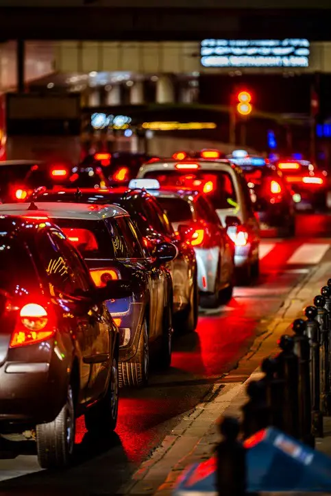
Rapid urban expansion is driving a critical rise in traffic congestion and intersection fatalities, posing complex traffic and safety management issues for many cities around the world. High traffic volumes and congestion directly impact quality of life, with pollution, stress, and wasted time taking a significant emotional and physical toll on road users. In the United States, travel on roads increased by+2.8% (+7.9 billion vehicle miles) for the month of October 2024 as compared with October 2023. Furthermore, the latest Inrix Global Traffic Scorecard reveals that that the average U.S. driver lost 42 hours to traffic congestion last year.
In addition to longer commute times and quality of life challenges, traffic congestion has increased the costs of transportation, affecting both individuals and businesses. Congestion cost U.S. drivers more than $70.4 billion in 2023, which was a 15% increase from 2022. For commercial vehicles, the cost is even greater. The American Transportation Research Institute’s 2024 report states that congestion cost the U.S. trucking industry $108.8 billion in 2022.
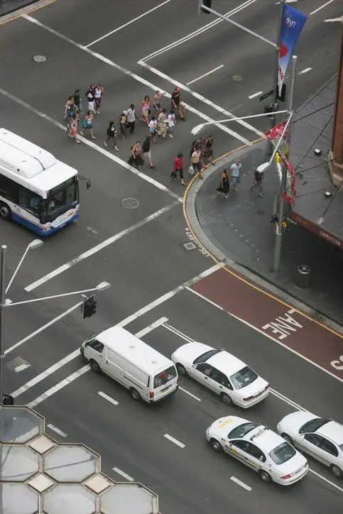
As urban road users increase, so have intersection safety events. Each year, roughly half of all traffic injuries in the United States are attributed to intersections. According to the Federal Highway Administration, there were a total of 42,514 traffic fatalities recorded in 2022 in the U.S., of which 12,036 involved an unsignalized intersection. The fatality rate drops to 4,204 fatalities at signalized intersections, with many incidents driven by red light runners and other dangerous behavior such as wrong-way drivers. These statistics highlight the ongoing challenges in road safety improvement and the urgent need for better traffic management strategies.
Additional challenges also include keeping ahead of changing traffic conditions. Midday traffic has surged by an astonishing 23%, signaling a significant shift in peak travel times, which has important implications for urban mobility and transportation planning. This shift suggests that traditional approaches to traffic management may no longer be sufficient. To better accommodate these new traffic patterns, city planners and policymakers may need to adjust traffic signal timings, revise public transportation schedules, and rethink road maintenance strategies. Adapting to these evolving trends will be key to ensuring smoother, safer and more efficient urban transportation systems.

As many cities anticipate unprecedented growth, the demand for intelligent and efficient traffic and intersection management is now more urgent than ever. This article delves into traffic actuation, detailing how municipalities and transportation agencies can leverage lidar technology to modernize traffic management, enhance data collection, and optimize traffic flow—all while enhancing the safety of road users.
What is traffic actuation?
Traffic signals, also known as traffic lights, are a key part of traffic management systems designed to regulate the flow of vehicles and pedestrians at intersections, pedestrian crossings, and other areas with high traffic. Traffic signals work by coordinating traffic light changes based on fixed timing between green, amber and red lights; the signals are pre-programmed to switch between lights at regular intervals (for example, every 30 seconds or one minute, etc.). This is the simplest form of traffic signalling that is often used in places with predictable traffic patterns to ensure traffic flows smoothly and safely, minimizing accidents and congestion.
Traffic actuation, on the other hand, describes a specific type of traffic signal that uses sensors to detect vehicle or pedestrian presence to adjust the signal timing based on real-time traffic and road conditions. Actuation involves the use of various detection technologies such as lidar, inductive loops or cameras, that help to detect traffic conditions in real-time, triggering or modifying signal changes to manage traffic flow more efficiently. Essentially, traffic actuation helps ensure that traffic signals respond to the current situation on the road, rather than relying on fixed timers that could be inefficient and cause unnecessary delays.
The most common types of traffic actuation systems used today are fully-actuated and semi-actuated systems, which allow traffic signals to adapt dynamically based on real-time traffic conditions. These systems are designed to optimize traffic flow by adjusting signal timings according to vehicle and pedestrian demand. With advancements in sensor technology and traffic management software, these systems have become common in urban traffic management, offering more efficient and responsive solutions to the challenges of modern transportation networks:
Fully-actuated traffic actuation is a mode of traffic signal control where the signal system operates entirely based on real-time detection of traffic conditions in all intersection approaches, without relying on fixed time cycles or pre-set patterns. In this mode, detection is provided on all approaches to the intersection, meaning that sensors or other detection technologies (such as inductive loops, lidar, or cameras) are used to detect vehicles at every approach to the intersection, including all lanes.
Semi-actuated mode is a type of traffic signal control system where detection is provided on specific approaches to an intersection, typically on side streets or for specific turning movements, such as left turns on the main road. This system adjusts the traffic signal based on the presence of vehicles on these minor approaches while maintaining fixed cycles for the main road (or the primary direction of traffic flow).
Types of traffic actuation systems:
Traffic actuated signals can be both demand activated and dynamically adaptive based on the underlying technology in use. While both systems refer to traffic signal systems that adjust based on real-time traffic demands, the key difference lies in their level of sophistication. Demand activated systems simply respond to the presence of vehicles at the intersection, triggering signal changes as needed in real-time. For example, giving more green time to the direction with higher traffic demand at any given moment. On the other hand, adaptive traffic actuation employs advanced algorithms to analyze traffic data and continuously optimize signal timings based on evolving conditions in real-time or semi real-time, offering a more dynamic and responsive approach to traffic management.
Examples of traffic actuation in use:
Intersection traffic control: At a busy intersection, traffic signals might be actuated to prioritize traffic on a main road during peak hours. A side street will only get a green light when there are vehicles waiting at the stop bar, reducing unnecessary waiting times.
Pedestrian crosswalks: At a pedestrian crosswalk, when someone presses a button to cross, the signal will act by switching to the pedestrian phase. In more advanced systems, sensors can detect pedestrians waiting to cross without needing a button press.
Public transit: On a bus or tram route, transit signal priority (TSP) allows buses to have green lights for longer periods or to extend green lights when buses are approaching, reducing delays and improving the efficiency of public transportation systems.
Emergency vehicle preemption: When an ambulance, fire truck, or police vehicle approaches an intersection, emergency vehicle preemption systems can change the lights to green in the direction of the emergency vehicle, allowing for faster passage through the intersection.
The benefits of traffic actuation are far reaching, including improved traffic flow, reduced congestion and wait times, enhanced safety and energy/cost efficiencies.
Common traffic actuation system: Stop bar detection using inductive loops
Stop bar detection refers to the use of a sensor, commonly an in-roadway inductive loop, which is a type of vehicle detection technology used in traffic management systems. The loops are electromagnetic sensors and are essentially buried wire coils in the road that are placed at the stop line of a traffic intersection to detect when a vehicle has passed over or stopped at the light/on the loop. Inductive loops signal the traffic signal controller that a vehicle is waiting to proceed. If the system detects that there are vehicles waiting at the stop bar, the controller might extend the green light, change to green for that direction, or adjust the timing of the light based on the traffic flow.
While once a staple of traffic management, inductive loops’ significant drawbacks make them increasingly less viable in today’s multimodal roadways and intersections.
Limitations of inductive loops:
Limited detection range: Inductive loops can only detect vehicles that are directly over or near the loops. This means that if a vehicle is stopped slightly behind the stop bar or if a smaller vehicle (such as a motorcycle) doesn't cover enough of the loop, it might not be detected, leading to delays or misoperation of the signal.
No multimodal capabilities: Indicative loops are unable to accurately classify and detect all types of road user including pedestrians and cyclists. In addition, they cannot differentiate between vehicles and bikes on a shared bike lane.
Poor reliability: Over time, the inductive loop sensors can degrade or become damaged due to road wear, weather, and traffic. When this happens, the traffic signal may not detect vehicles properly (or at all), leading to malfunctioning signals or unnecessary delays.
Limited adaptability: Legacy systems generally can't dynamically adjust to changes in traffic flow as easily as modern systems. For example, changing detection zone size or location to adapt to new traffic needs.
Installation & maintenance costs: Installing inductive loops requires cutting into the pavement to lay the wire, which often involves lane closures and significant disruption to traffic flow. The process is laborious, making both installation and maintenance costly, not to mention inconvenient for road users and city officials.

While still common, inductive loops are being gradually replaced or supplemented with more advanced technologies that offer better flexibility, accuracy, and adaptability for modern multimodal traffic management needs.
Traffic actuation comparison technologies: Radar, infrared (IR) and camera systems
There are different non-intrusive sensor technologies available to replace inductive loops such as radar, camera and infrared technologies (also lidar that will be discussed later in this blog). However, there are common drawbacks associated with these technologies, which are summarized in the table below:
Traffic Actuation Technology |
|
|
Radar-based sensors | Weather resilient (works in rain, snow, fog) | Limited object classification (cannot typically classify different types of road users e.g. pedestrian, bikes, vehicles, etc.) |
Long detection range | May struggle detecting stationary & closely-spaced objects. For example, vehicles stopped at a light | |
Non-invasive (no need to cut into pavement) | Potential for sensor interference in dense areas | |
Good for moving vehicles | Requires precise installation and alignment | |
Infrared Sensors | Effective in low-light conditions | Susceptible to environmental factors (rain, fog, haze, snow, sunlight) |
Cost-effective | Short detection range & limited object detection (e.g., difficulty detecting cyclists, etc.) | |
Non-invasive | Needs periodic lens cleaning, often requiring lane closure | |
Effective for short-range detection | Subject to interference from background heat sources | |
Camera-based detection | High accuracy in vehicle classification & tracking | Privacy concerns due to video recording |
Multimodal detection (vehicles, pedestrians, cyclists) | Struggles in low-light or adverse weather conditions such as fog, rain or snow | |
Provides rich data & analytics | Can be expensive to install & maintain (often requires calibration and sometimes complex software integration) | |
Flexible and covers wide areas | Data overload requires strong computing resources & software. Managing & analyzing this data can add to operational complexity | |
Provides 2D not 3D detection |
Why is 3D digital lidar better for traffic actuation?
Lidar is a powerful sensing technology that uses laser beams to create high-resolution 3D maps of the environment, providing real-time data about vehicle and pedestrian movement, traffic conditions, and environmental factors.
Ouster digital lidar offers significant advancements in addressing the limitations of conventional inductive loops, cameras, and infrared and radar sensors:
High-resolution 3D mapping: Ouster digital lidar sensors continuously scan the environment and can produce up to 5.2 million points per second by processing light returns from each laser beam shot. Point clouds from the environment provide a 3D digital representation of an intersection or road to enable the accurate detection of road users.
Real-time data collection and processing: Ouster BlueCity’s lidar sensors offer unparalleled accuracy and reliability in gathering real-time data about the environment. Unlike traditional cameras or radar, lidar provides detailed, 360-degree views of intersections, including accurate measurements of distances, vehicle speeds, and even pedestrian movements. This level of detail enables better decision-making, allowing traffic management systems to adapt to changing conditions quickly and efficiently.
Enhanced traffic flow optimization: With its high-definition sensing capability, lidar can detect and track the movement of vehicles with enhanced accuracy. This enables traffic management systems to adjust signal timings dynamically, improving traffic flow and reducing congestion. By analyzing real-time lidar data, systems can prioritize certain lanes, detect bottlenecks before they occur, and improve overall traffic efficiency.
High reliability in external conditions: Ouster digital lidar sensors provide detection in varying light, temperature and weather conditions ensuring quality data can be used reliably by the Ouster BlueCity perception software for traffic actuation.
Non invasive install and low maintenance: Installation is non-invasive, low cost and in the majority of deployments, the install does not require road closures or ongoing maintenance.
Privacy considerations: Ouster digital lidar sensors collect anonymized data, ensuring user privacy while still providing valuable safety insights.
Modernizing traffic management: Ouster BlueCity for traffic actuation
Ouster Blue City is a turnkey solution that delivers more intelligent signal actuation at intersections while generating an analytics data stream that gives traffic operators and city planners high quality insights about their intersections and public corridors.
Ouster BlueCity combines 3D digital lidar with perception software and data analytics, enabling the creation of a real-time 3D digital traffic twin of an intersection or road to reliably detect and classify multimodal road users for a modernized traffic management solution. What’s more, the exact same one or two lidar system deployment also provides road safety analytics and V2X integration.
The system automates data collection in the cloud to monitor road events more accurately for vehicles, pedestrians and cyclists, enabling quick safety interventions and long-term planning optimizations. Using deep learning AI perception, Ouster BlueCity delivers reliability and advanced object classification and detection for a range of complex use cases including traffic actuation, near-miss detection, outside of crosswalk events (jaywalking), red light running and wrong-way driving. In addition, data collected can also assist with speed, count and over-height monitoring, providing a truly complete and cost efficient traffic management solution.
Ouster BlueCity can be used to replace existing inductive loops as well as at intersections with no existing infrastructure. The system is also able to help with both demand activated and dynamically adaptive approaches (as discussed earlier in this blog):
Demand activated: provides presence/stop bar detection as a more reliable replacement of costly loop systems.
Dynamically adaptive: Prepares the intersection by providing more advanced data that traffic controllers can use for traffic signal optimization, including trajectory, speed and safety parameters.
With a simple and non-invasive two lidar intersection installment, municipalities and DoTs can dynamically manage traffic signals, decrease traffic delays and improve the safety of all road users.
Ouster BlueCity installed at a busy Chattanooga city intersection.
How does Ouster BlueCity work for traffic actuation?
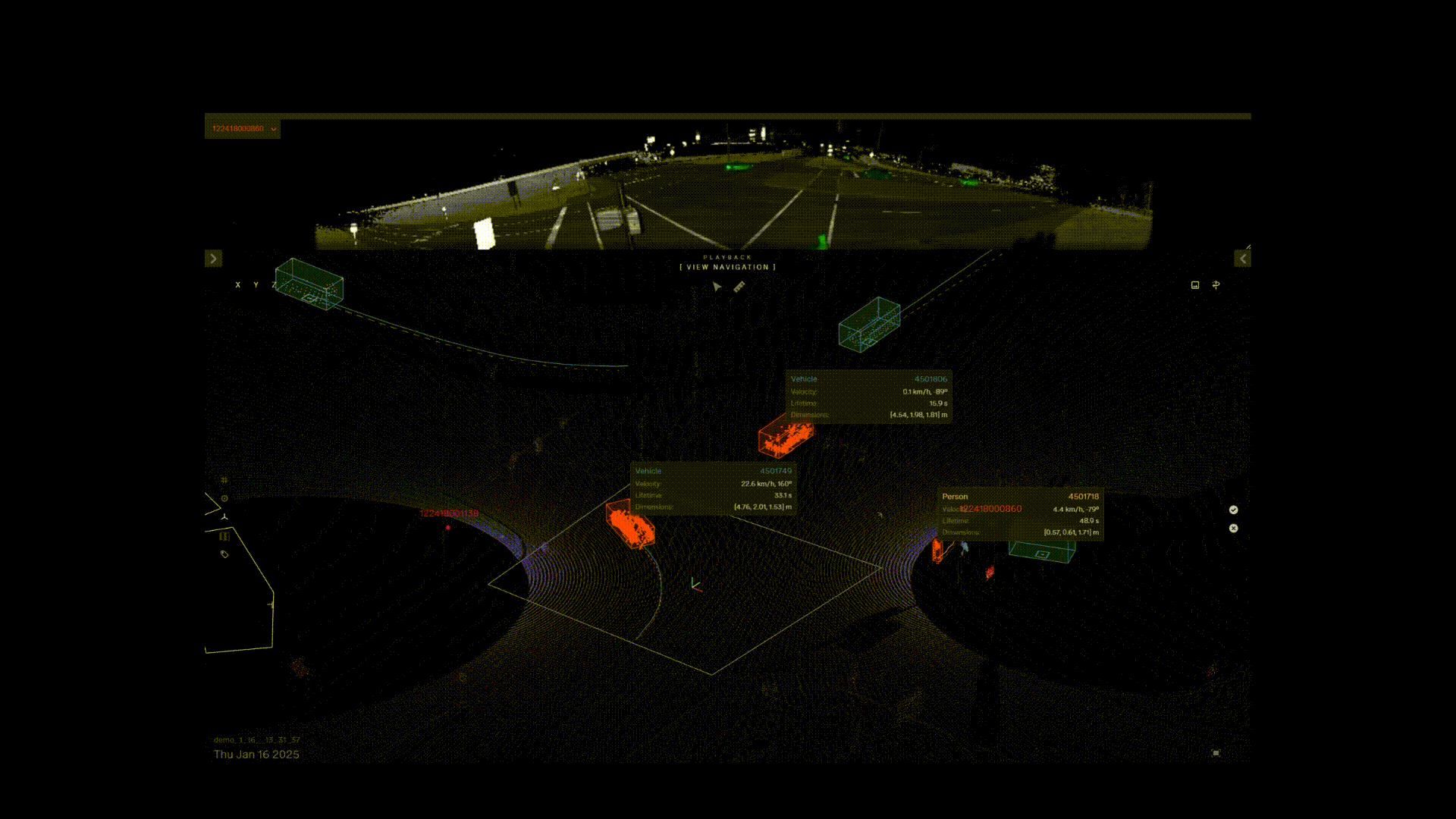
Ouster BlueCity enables adaptive traffic actuation by providing trajectory-based real-time 3D detection and classification of road users. The system identifies vehicles, pedestrians, and cyclists within 3D virtual detection zones (also known as virtual loops) to gather accurate real-time data. Data collected is transmitted via the NTCIP, SDLC or Dry-Contact protocol, enabling traffic controllers to optimize traffic flow and adapt to changing traffic conditions, ensuring more efficient traffic management and helping to reduce safety related events. From there, signal adjustments are based on a wide range of inputs such as:
Zone occupancy
Vehicle counts
Traffic density
Time of day (such as rush hours, special events or changing peak hours)
This adaptive approach ensures that signal timings are always aligned with current traffic demand, enhancing both traffic efficiency and safety.
Using the Ouster BlueCity web interface, users can create 3D virtual loops for different types of road users across the detection area of the sensor. Any number of virtual loops can be created, including virtual loops on top of each other. This flexibility is extremely advantageous and helps transportation agencies to fully optimize an intersection based on the unique needs per intersection.
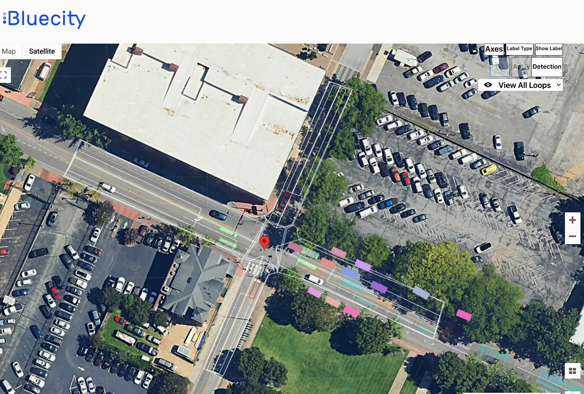
Visual of virtual loops created and active in Ouster BlueCity dashboard
The system actuates traffic light controllers over the NTCIP, SDLP, and Dry-contact protocol, depending on the controller's compatibility. Standard MIBs allow external systems to send calls per phase and receive real-time traffic signal status, which is then used by the analytics platform to provide signal performance measures and other safety-related insights. Ouster BlueCity allows traffic controllers to access and respond to real-time traffic data that can be used to adjust signal timings based on current conditions.
Ouster BlueCity install and set-up steps for traffic actuation:
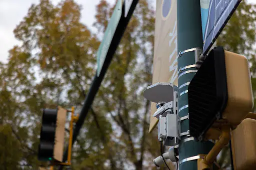
Lidar installs: Ouster’s digital lidars can be easily installed using Ouster mounting kits on an existing traffic pole, which is on the curbside of the intersection. It is recommended that two Ouster lidars are used to cover a typical four-way intersection, which includes all four approaches and the center of the intersection - critical for traffic actuation.
Due to the range and 3D spatial awareness, Ouster lidars do not need to be installed on the mass arm above the road, unlike many other sensors or cameras. The installation ensures minimal or no disruption to traffic or road closures and provides more safety for workers. In addition, the height of the installed sensors (15-18ft) makes it less sensitive in windy conditions, therefore helping to avoid damage or downtime.

Ouster BlueCity installation setup
Set-up the edge computer: A CAT6 cable connects the lidar to the edge computer as shown in the diagram. Users have a choice of configuring the system i) from their own network, ii) directly at the intersection or iii) over the internet using Ouster’s cloud-based interface.
- Connect system to traffic controllers and set parameters: In the Ouster BlueCity configuration tool, users can easily set the parameters for communications protocol to NTCIP (National Transportation Communications for Intelligent Transportation Systems Protocol), SDLC (Synchronous Data Link Control) and Dry-contact, which enables interoperability between the Ouster BlueCity system and the Intelligent Transportation Systems (ITS). The connection enables the system to receive detection status as frequently as every 100 milliseconds ensuring a seamless, real-time interaction between traffic signals and the system.
The system allows you to assign up to 64 channels, which is aligned with the traffic controller requirements. Each channel will be ideally aligned to one detection zone (although more than one detection zone per channel can be created). The controller is then able to see the calls based on the predetermined calls per channel.

- Define vehicle approach phases: Within the Ouster Blue City configuration tool, users can define allowed turning movements for each phase during green and red. The information used in the analytics can identify red light violations.

- Defining virtual loops: Once the phases and controllers are set, a 3D stop-bar virtual loop known as a ‘presence’ loop is drawn using the configuration tool in the areas where detection is required. Presence loops are assigned to a specific phase, approach and channels. The algorithm will use the location of vehicles or pedestrians along with other attributes such as speed and heading of the objects to determine how to actuate traffic signaling based on real-time conditions. Each loop is assigned to one or more phases or channels.
As Ouster digital lidars can effectively monitor all four approaches with a 360° field of view (as opposed to just a directional approach), the system can detect and respond to spillback congestion by extending the red light for through vehicles on certain approaches, thereby avoiding a blocked intersection.

Ouster BlueCity traffic actuation demo
The demo showcases Ouster BlueCity traffic actuation working end-to-end with traffic controllers and shows three live views i) vehicles detected and classified using Ouster BlueCity software in real-time ii) same vehicles detected within virtual loops/detection zones in the Ouster BlueCity cloud-based dashboard iii) view of the traffic controller’s GUI receiving traffic communications directly from Ouster BlueCity
Why Ouster BlueCity for traffic actuation: ending an era of inflexible inductive loops
Ouster BlueCity provides a complete, reliable, and more cost-effective solution versus traditional inductive loops and other sensors such as radar, cameras and infrared. Connecting Ouster BlueCity’s intelligent solution to existing traffic controllers helps optimize signal timing and traffic flow based on real-time, 3D multimodal traffic data.
Rich lidar data is made available through the Ouster BlueCity cloud-based dashboard and requires no other external aggregated data sources, technologies or manual efforts. You can say goodbye to expensive consultants and limited data sample sets. By accessing accurate data 24/7, cities and transportation authorities can better determine safety or road interventions to implement to reduce fatalities and accidents, and enhance traffic flow.
Key features of Ouster BlueCity for traffic actuation:
Complete solution for actuation and analytics with V2X compatibility
Non-invasive installation and low maintenance
Real-time multimodal road user detection and classification
Unlimited virtual loops/ detection zones
Reliable tracking including stopped or slow moving vehicles
Resilience in varying light, weather or temperature conditions
24/7 cloud-based analytics
No PII data collected
Ouster offers additional peace of mind with NDAA compliance, and system-level NEMA TS2 and OS sensor Buy America(n) certifications.
Using American lidar and advanced perception software from Ouster, we are building the largest lidar-powered smart traffic network in the United States. This technology will enable optimized traffic signal management on roads and intersections to improve traffic flow and provide data we can use to improve pedestrian safety
Traffic actuation and analytics with the same sensor deployment
Throughout this blog we have explored Ouster BlueCity for traffic actuation, however, the solution offers so much more. This solution serves as a one-stop shop for your ITS needs; with the same intersection deployment, you can take advantage of a range of safety-related solutions and other data analytics - at no extra cost. This includes managing near-miss incidents, red light runners, jaywaking and wrong-way driving. To learn more about the additional benefits of Ouster BlueCity for road safety, read these Ouster blogs:
Ouster BlueCity: shaping the future of traffic signal management
The future of traffic actuation will be defined by intelligent systems that can process vast amounts of real-time data to adjust systems dynamically to optimize traffic flow. By leveraging the power of lidar technology, Ouster BlueCity is at the forefront of this evolution. To learn why cities such as Nashville and Chattanooga are investing in Ouster BlueCity for their traffic management and road safety needs, please reach to speak to one of our ITS experts here.
Related Articles
2026 ITS Trends
Physical AI is driving traffic innovation in 2026. Learn about lidar-powered signal optimization, proactive safety analytics, and city-wide V2X integration.

Signaling change: How to accurately detect red light running with digital lidar technology
Part 3 - Road safety series for National Pedestrian Safety Month: Red light running

Beyond the close call: Solving near miss detection with 3D digital lidar
Part 2 - Road safety series for National Pedestrian Safety month: Near miss detection