

Ouster is a company founded by and for roboticists. With 350 customers and counting, we receive a daily stream of photos and videos of our sensors being used all over the world, in all terrains and environments, and across an unbelievable range of applications. The enthusiasm of our customers energizes everyone at Ouster, and we’re eager to share some of their amazing work more broadly.
Today, we want to focus on one of our earliest customers, Apollo Robotics, who is democratizing access to low-cost, full-stack aerial surveying solutions for small businesses.

Meet The Surveyor
The team at Apollo Robotics is developing the first fully automated solution for surveying. Founded in 2015, they have already built The Surveyor, an unmanned aerial vehicle (UAV) with an integrated Ouster 64-channel lidar sensor, 20 megapixel RGB camera, radiometric thermal imager, and onboard artificial intelligence.
Apollo Robotics brings high resolution to the UAV market with Ouster’s OS1-64 lidar sensor, a compact, lightweight sensor that generates 1.3 million points per second. This level of point density means shorter flight times with greater accuracy and range repeatability. And although Ouster’s range repeatability is currently lower than more expensive lidars on the market, Apollo aggregates the large number of points in an area to improve range repeatability to 1cm. This is an unprecedented level of accuracy for surveying solutions anywhere near this price range.
Traditionally, drone survey solutions perform localization through an expensive Inertial Navigation System (INS). However, Apollo Robotics leverages Ouster’s high resolution lidar to perform Lidar feature matching onboard for accurate localization without requiring an expensive INS. As a result, Apollo Robotics offers an affordable Lidar UAV surveying solution and removes the need for frequent INS calibrations.

Survey to CAD in under an hour
Apollo Robotics also solves data latency challenges in the drone market. Previously, surveyors had to spend hours or days processing the titanic amount of data generated, but the Apollo Surveyor’s onboard computers have GPUs accelerated with CUDA libraries to drastically reduce the processing time.
Apollo completes post-processing within an hour of flight, creating photorealistic and digital terrain models almost instantaneously. This makes it possible for customers to quickly import the data into CAD and begin their design process the same day as the survey flight.
High resolution vegetation filtering
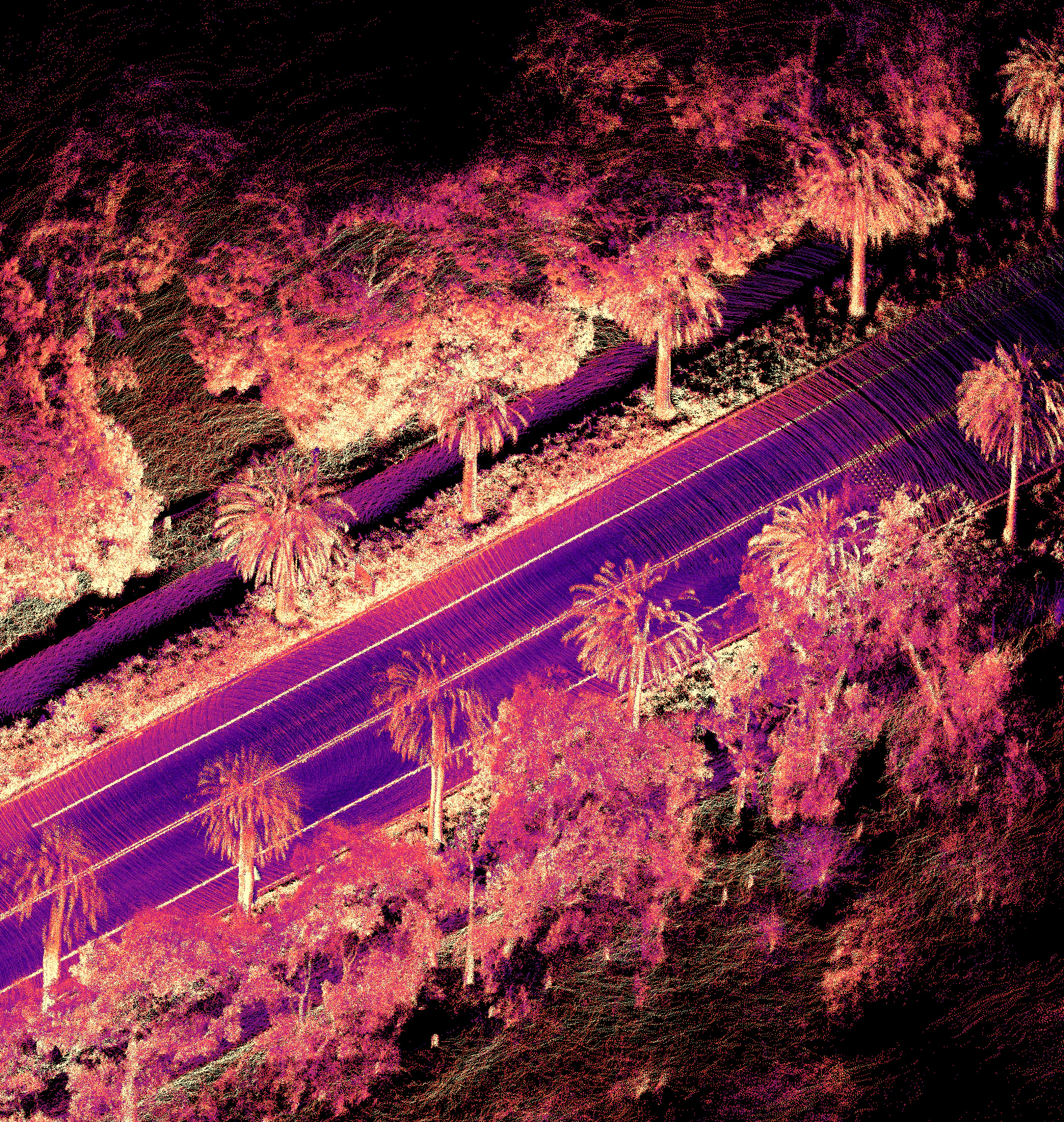
Apollo Robotics completes vegetation filtering with the OS1-64 lidar sensor, despite the fact that the sensor currently only has single return capability. This is truly amazing for a market that widely believed dual returns were necessary for vegetation and canopy penetration, and is made possible by Ouster’s high resolution and small beam size (25 cm at 100 m).


What’s also remarkable in both of these clips is that Apollo was able to survey 50 acres in under 12 minutes, powered by Ouster’s point cloud density.
With a focus on “bringing accessibility and digitization to professional land surveying”, Apollo Robotics is bringing their surveyor drone to the market today to start delivering on their $3 million in pre-order reservations. The team continues to make improvements to transform the growing surveying market and we can’t wait to see the detailed maps they generate!
Related Articles

Built to last: Why Ouster BlueCity is a rugged and reliable choice for ITS deployments
Defining a New Era of Durability in ITS
Introducing the REV8 OS Family: The World’s First Native Color Lidar
A new generation of Ouster digital lidar, powered by custom L4 Ouster Silicon. Rev8 introduces native color lidar, provides up to double the range and resolution, and is designed for functional safety, reliability, affordability, and scale.
Freie Universität: High-Precision, Small-Footprint Mapping
Researchers at Freie Universität Berlin are changing a storage paradigm for autonomous navigation. By using Ouster OS2 digital lidar to create ultra-lightweight bird's-eye-view maps, the team achieved sub-50cm localization accuracy with a map footprint of just 4 MB per square kilometer.